


TRIP FACTS
Price: 599.900 ISK
Tour type: Backpacking
Duration: 9 days - 8 nights
Walking per day: 6 - 8 hours
Group size: Min. 4 - Max. 12
Accommodation: Tent
Language: English
Meeting point: N1 station in Kirkjubæjarklaustur
FAQ: See our Frequently Asked Questions here
Do you want a private departure of this trip? Contact Us, or send an email to info@arctichiking.is
HIGHLIGHTS OF TOUR
-
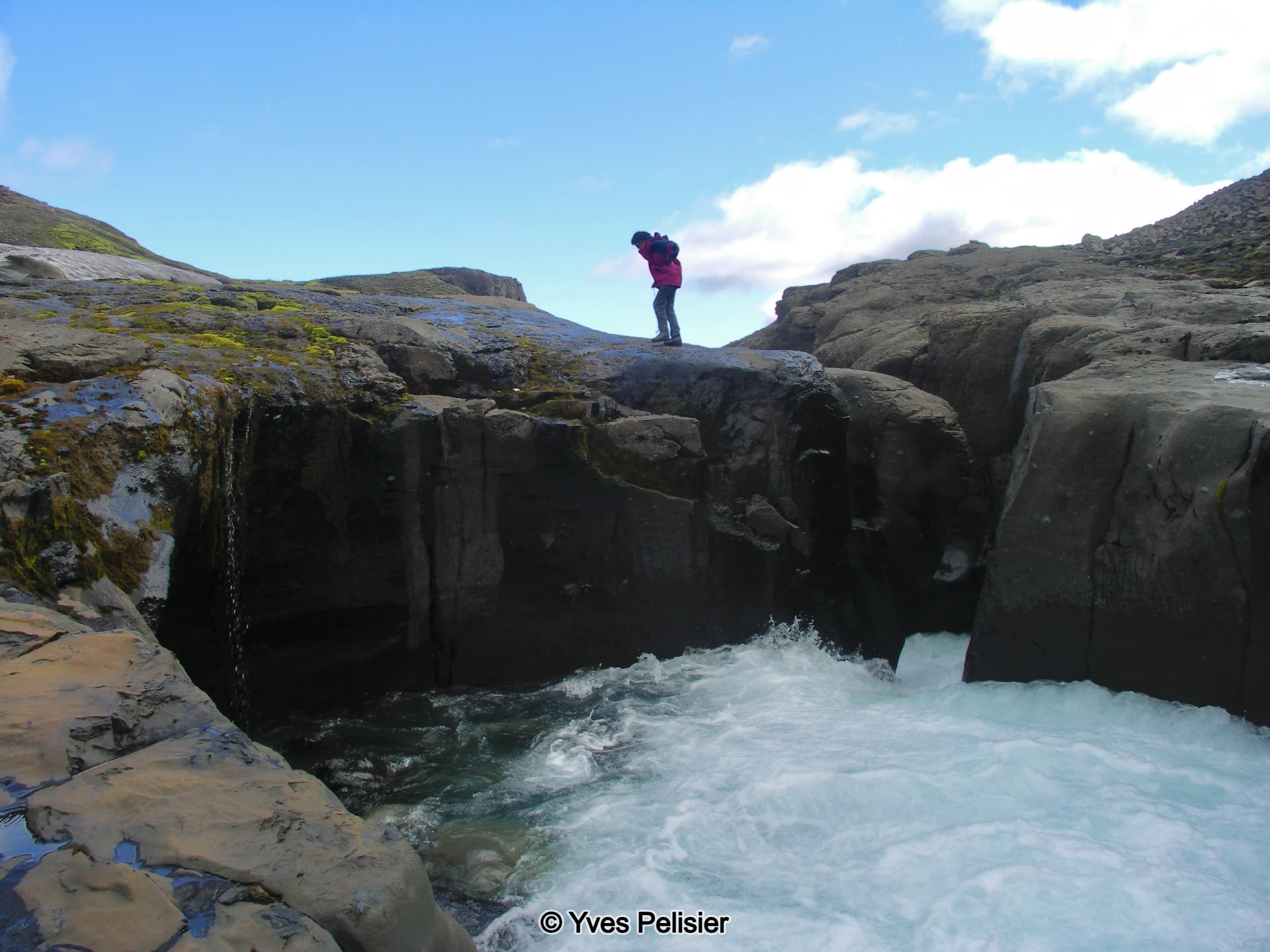
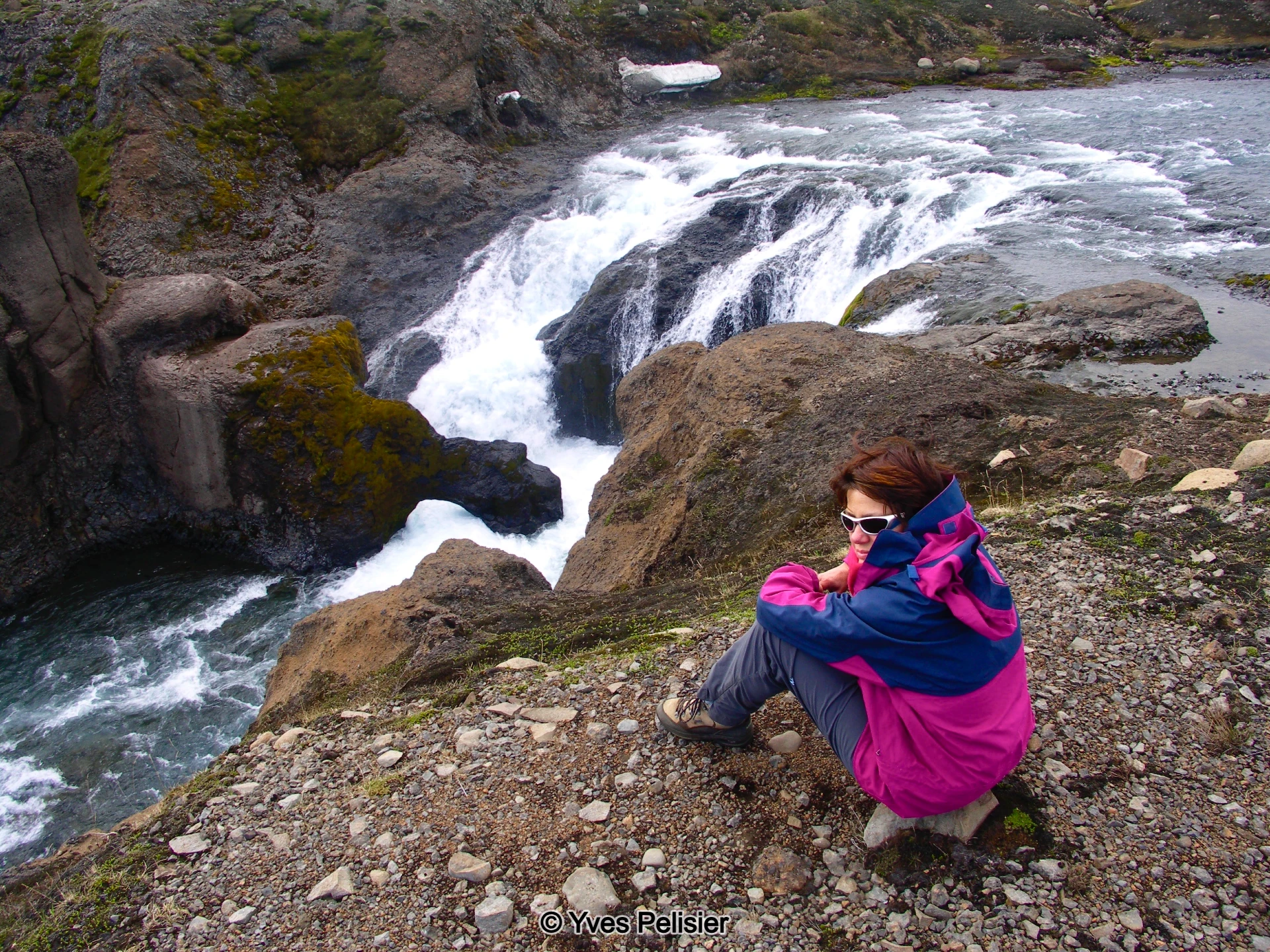
- Pictoresque waterfalls and canyons.
-
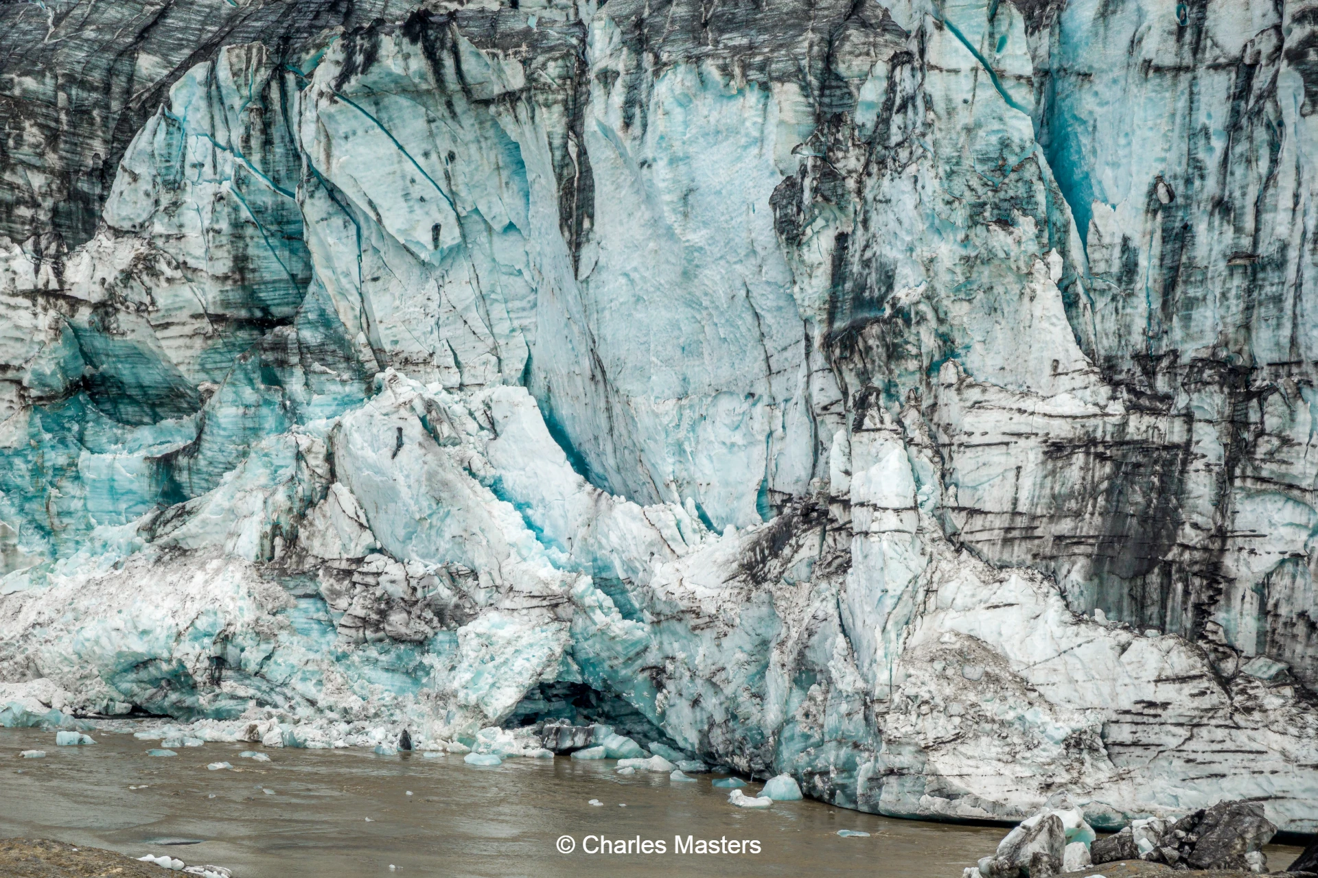
- The mighty Vatnajökull and its outlet glaciers.
-
- Striking volcanic craters.
-
- Historic lava flows and birchwoods once used for charcoal production.
-
- Panoramic views over Skeiðarárjökull.
-
- Glacier crossing, a diverse landscape of creeks, streams and ice pyramids.
-
- Breathtaking scenery boasting colourful rhyolite mountains, glacier-filled valleys, and sharp summits.
Origins of the Trail
In 1992, two guide friends found themselves captivated by the highlands to the south of Vatnajökull glacier. Their shared interest led them to embark on an exploratory journey through the region on foot that September, marking the beginning of what would become The Old Coal Trail.
The Highlands Landscape
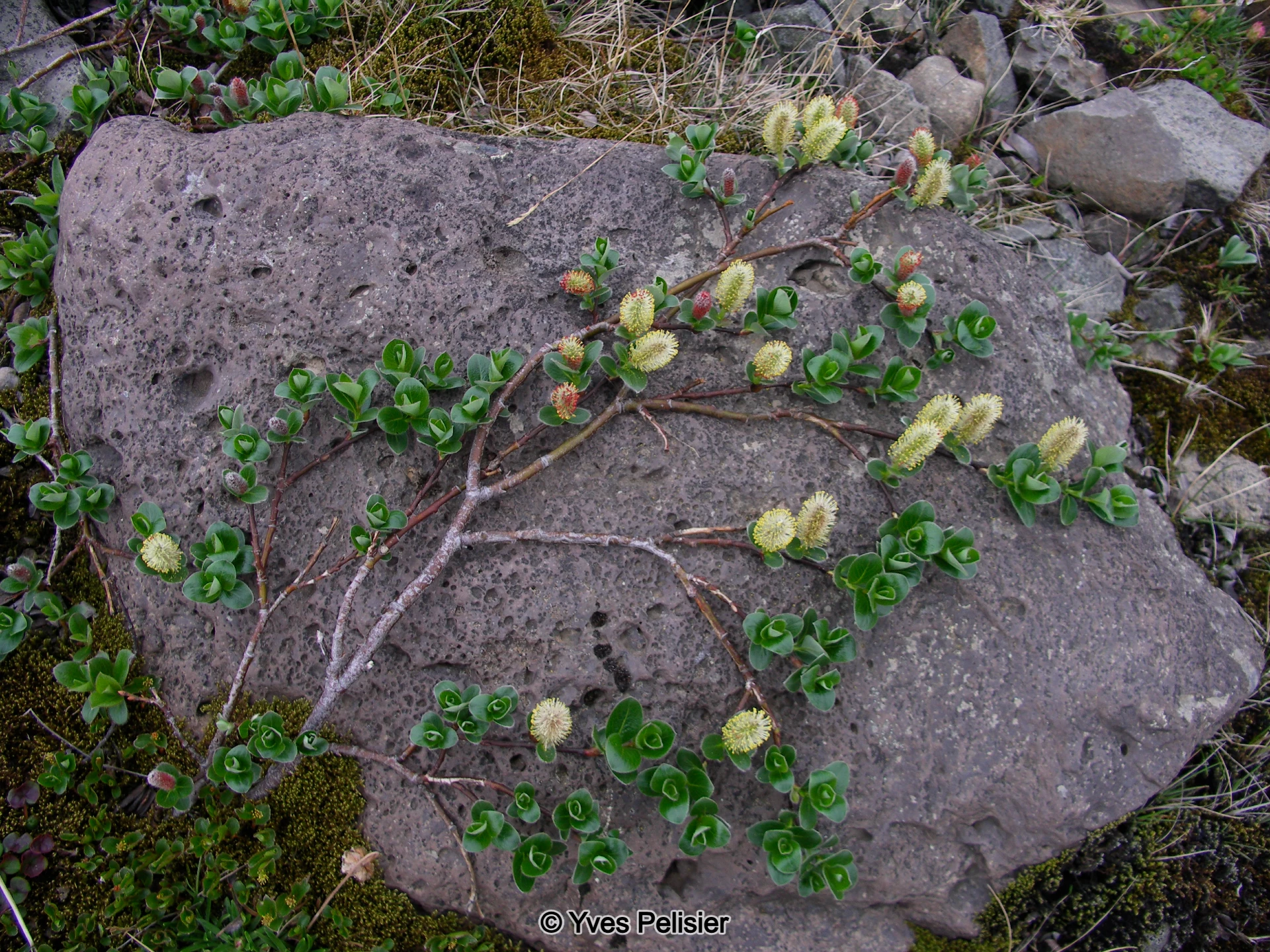
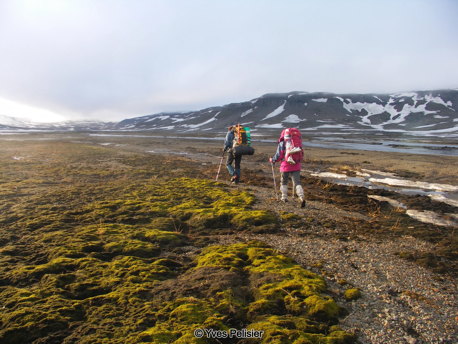
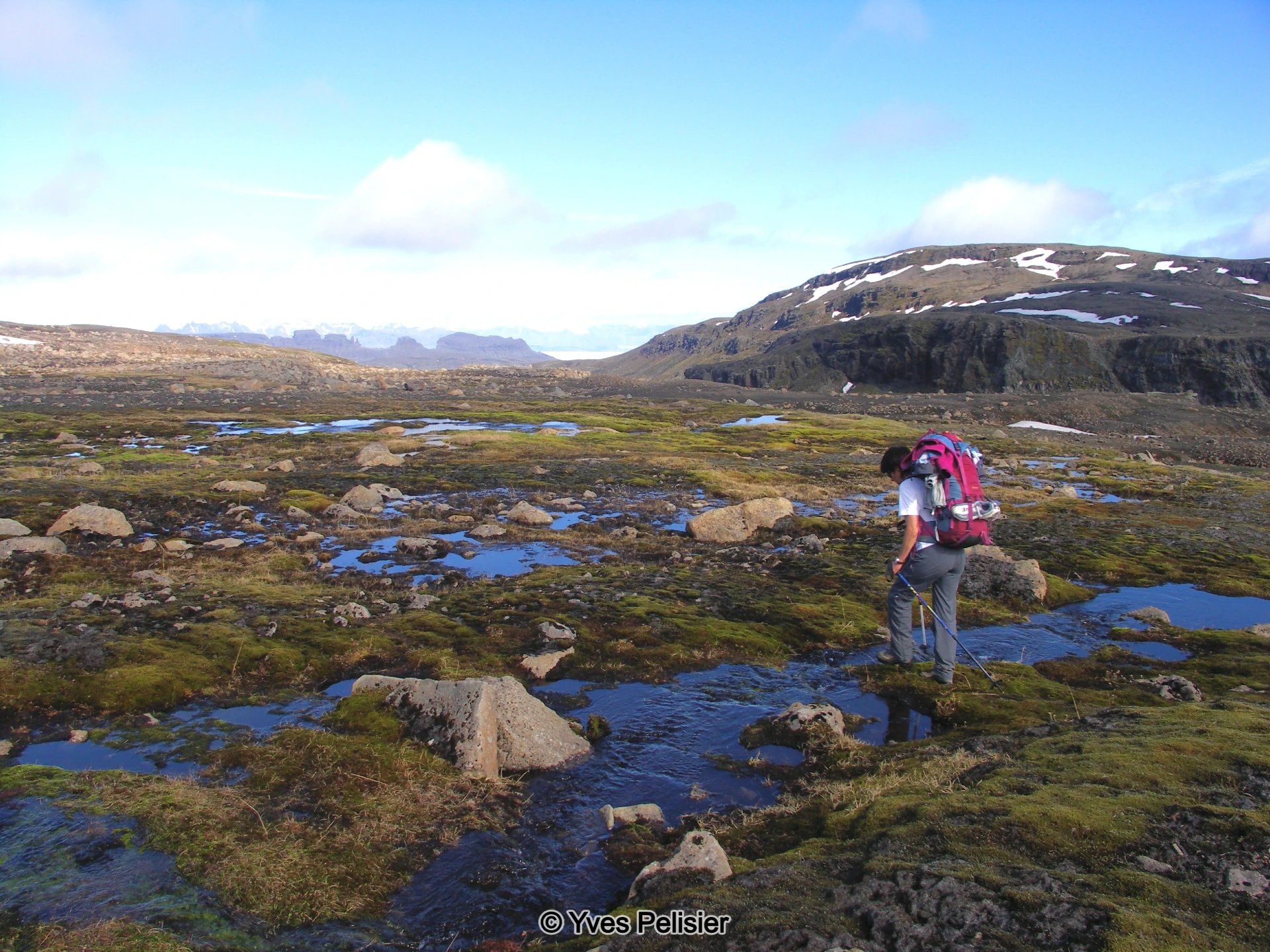
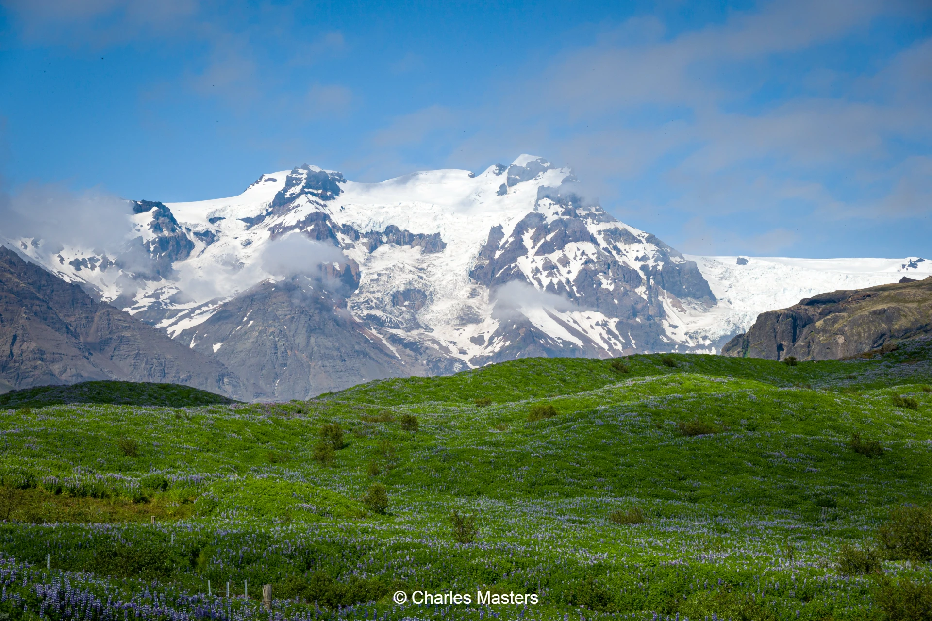
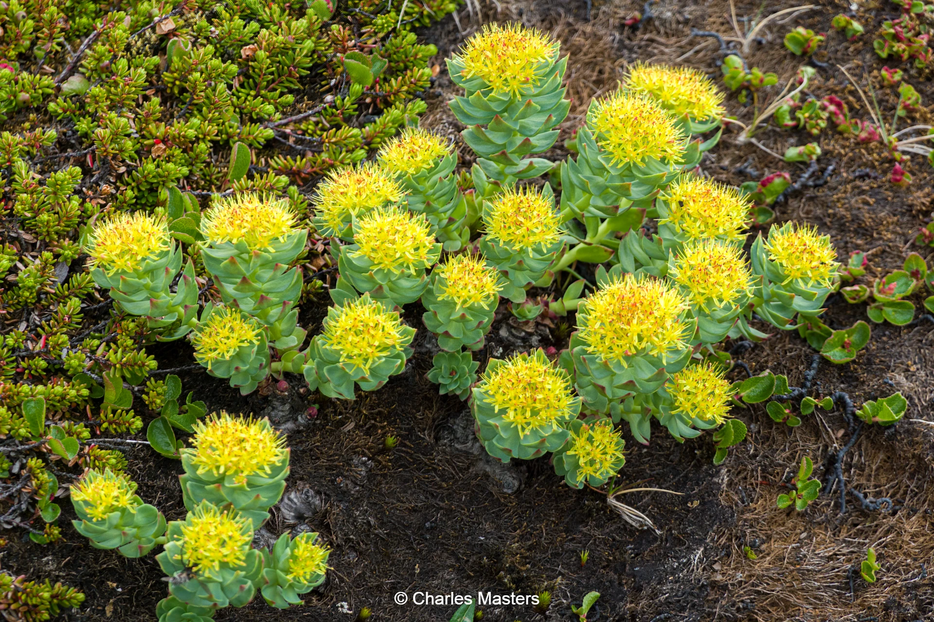
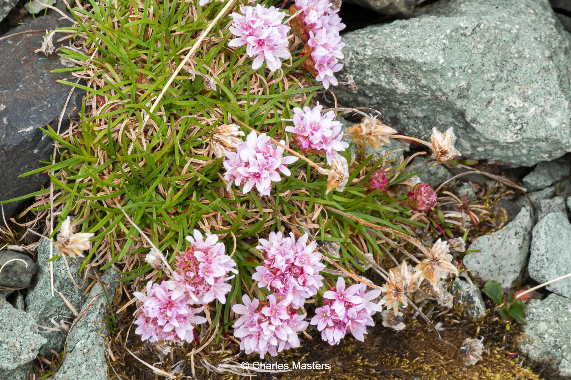
The highlands south of Vatnajökull glacier present a truly spectacular array of natural features. This area boasts dramatic lava fields, deep canyons, moraines, valleys, waterfalls, serene lakes, cold springs, imposing mountains, glacier outlets, lively creeks, and both spring and glacial rivers. Amidst this rugged terrain exists a delicate arctic flora, several hardy bird species, and the elusive arctic fox. The trek through this remote region unveils hidden landscapes that remain untouched by vehicles, and only a select few backpackers and shepherds have travelled these paths. Often, the journey is marked by a rare solitude, with little to no encounters with other people along the way.
Journey Into Núpsstaðarskógar
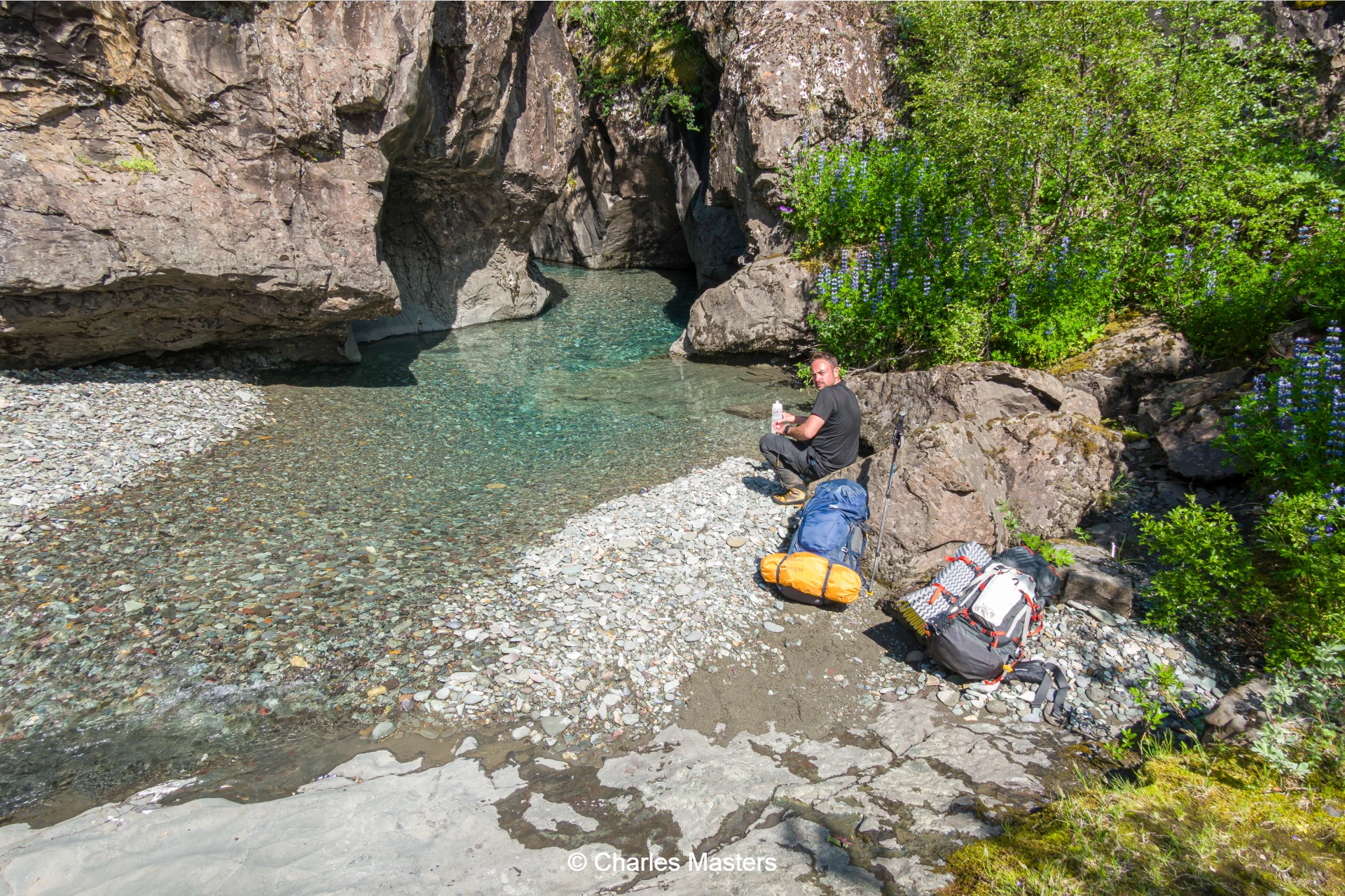
Historically, when farms relied on combustible materials for fuel, farmers would venture into the birch forest of Núpstaðarskógar. Surrounded by imposing mountains, canyons, and broad rivers, access to parts of this forest was only possible from the north, bypassing major obstacles. This five-day trek leads travellers to the forest’s hidden reaches, revealing a landscape both harsh and breathtakingly beautiful.
From Núpsstðarskógar to Skaftafell
The trail from Núpsstaðaskógar valley to Skaftafell (0riginally established by our own Einar Torfi Finnsson and his friends) within the Vatnajökull National Park has grown into one of Iceland’s most renowned backpacking routes. The remote and rugged landscape makes this trek a challenge best undertaken with an experienced guide or substantial expertise in traversing Icelandic volcanic mountain regions. Drawing upon our extensive knowledge of the area, Arctic Hiking ensures that each day of the journey is carefully planned, striking a balance between daily distance and walking hours for a rewarding experience.
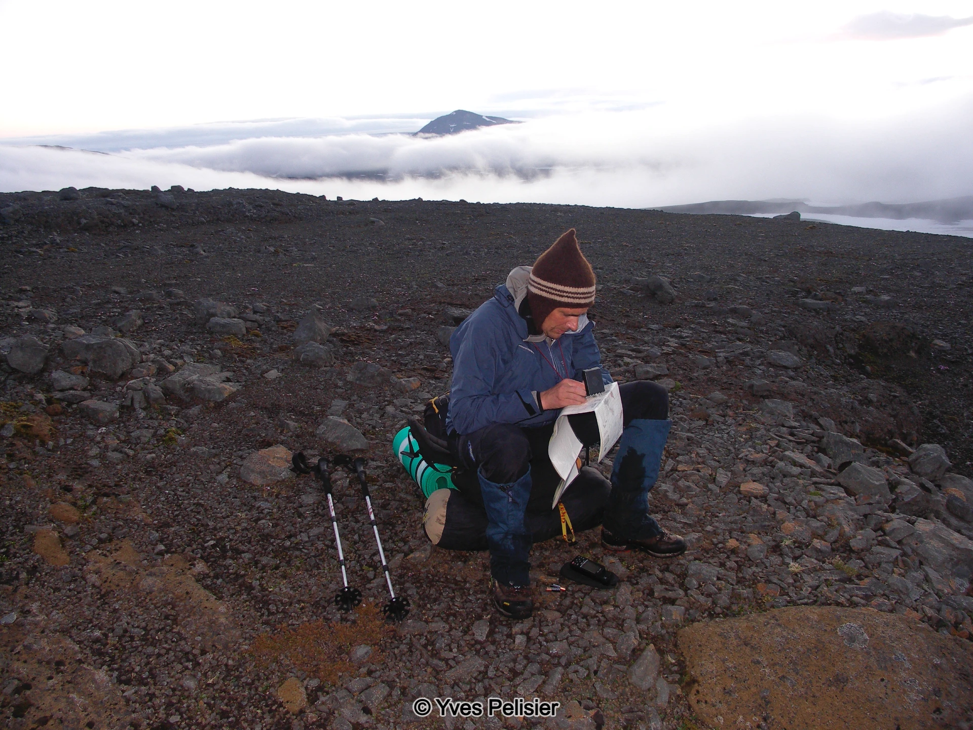
Itinerary
Meeting and Preparation
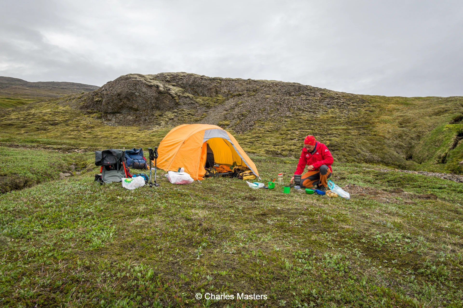
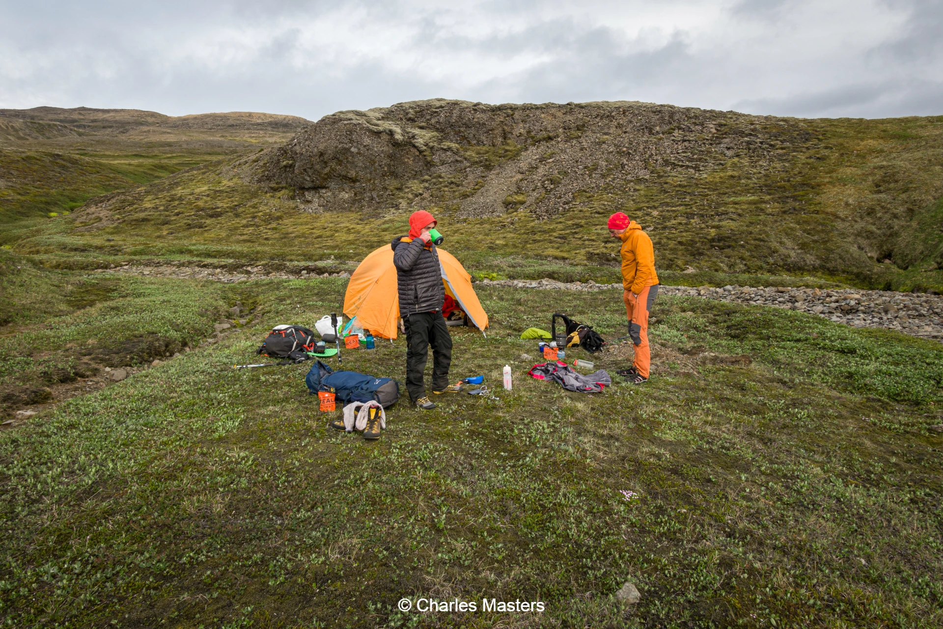
The adventure begins on Monday morning in Kirkjubæjarklaustur, with the meeting point set for 08:00 at the N1 service station. Here, participants meet their guide, receive supplies, and organise shared equipment. At 08:45, a short transfer of approximately 30 minutes takes the group to the starting point of the hike.
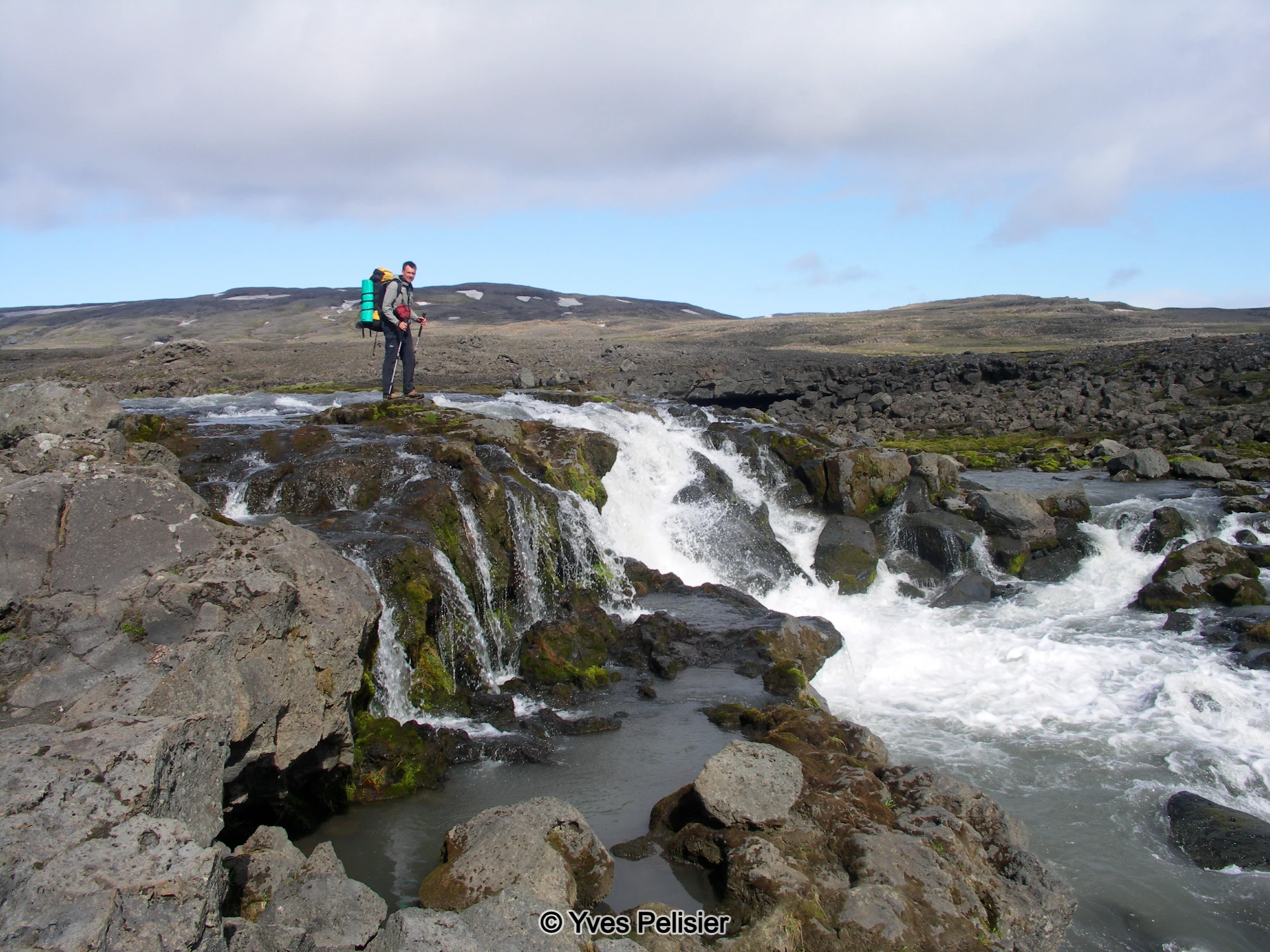
Day 1: Along the Djúpá River
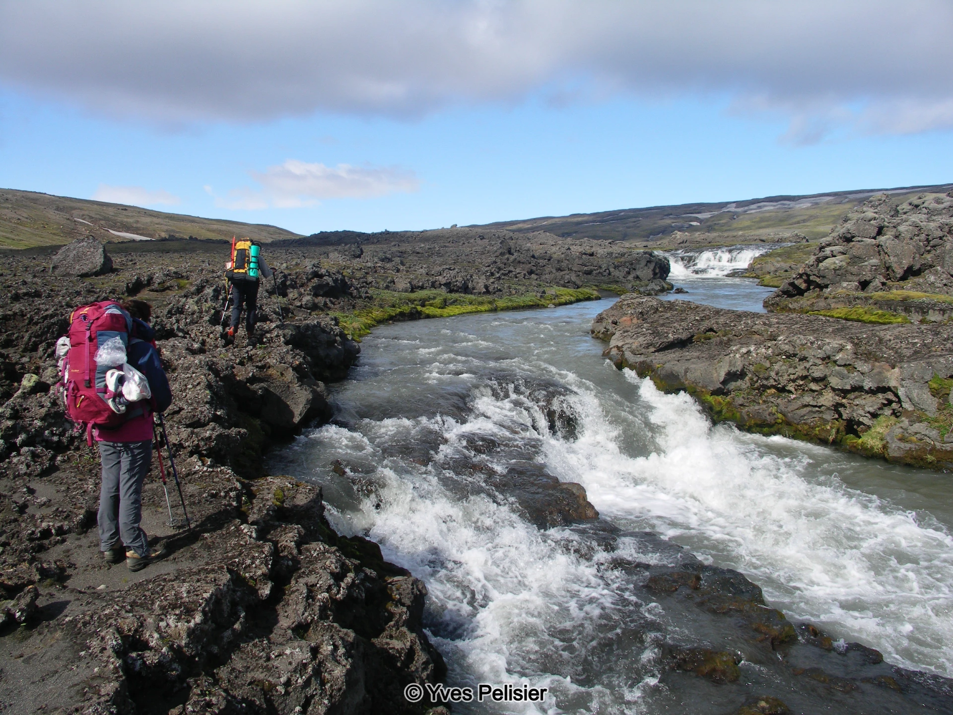
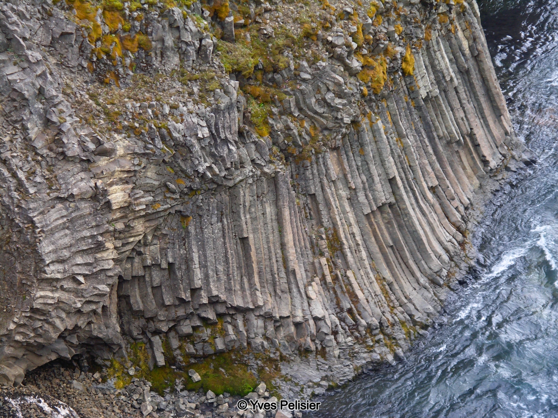
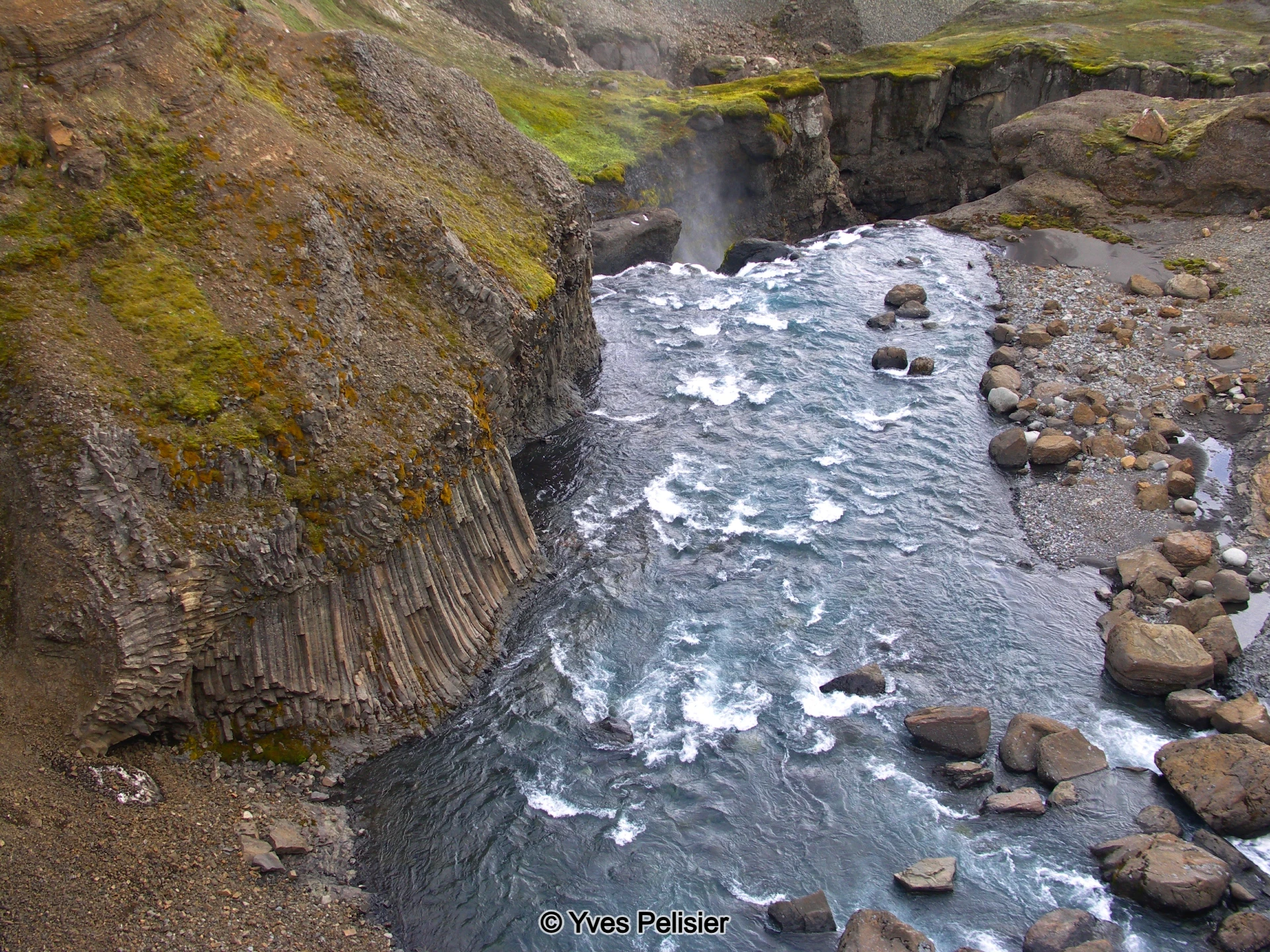
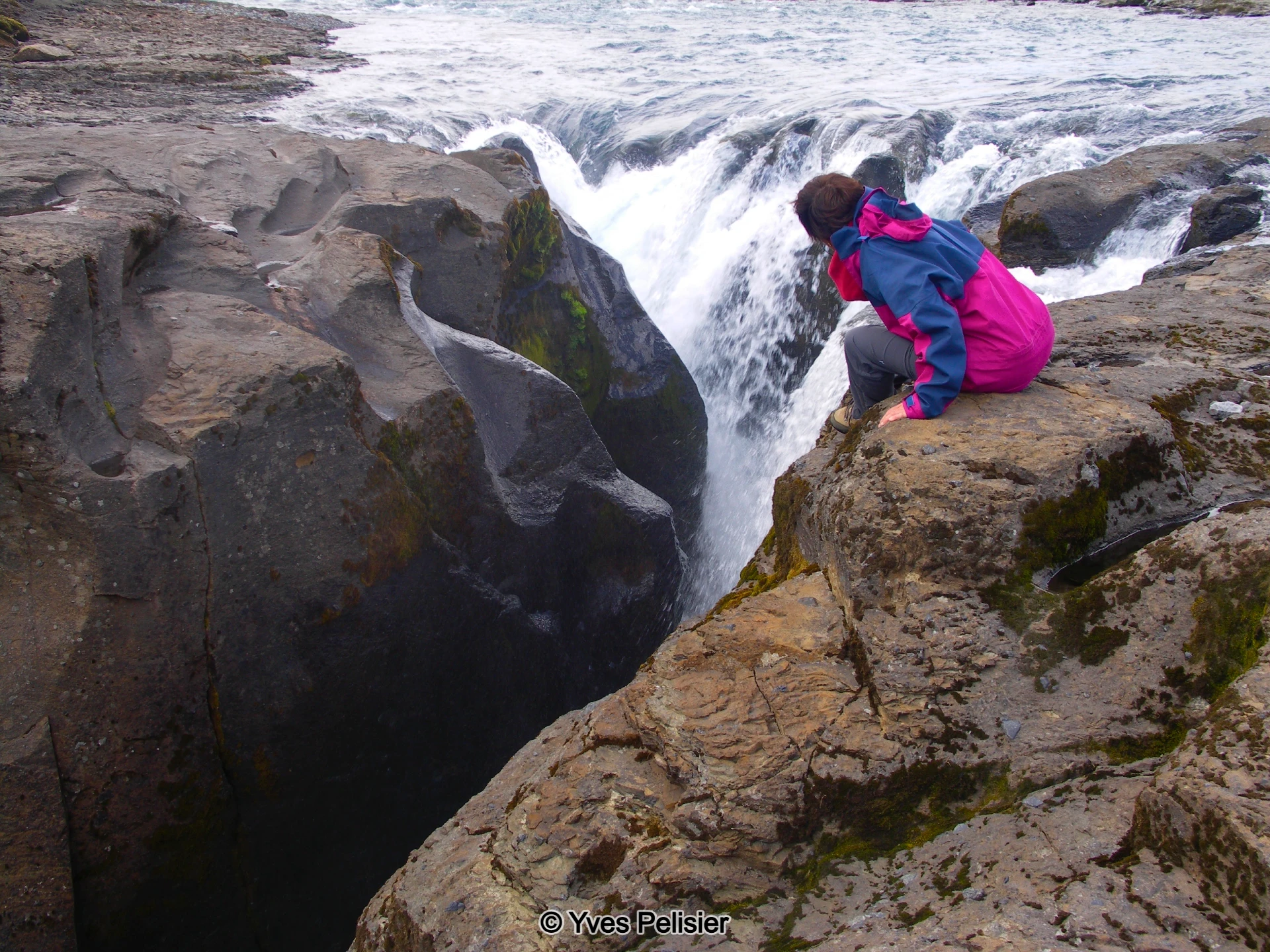
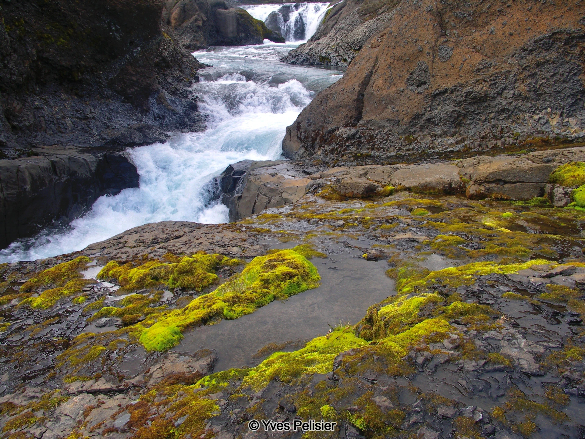
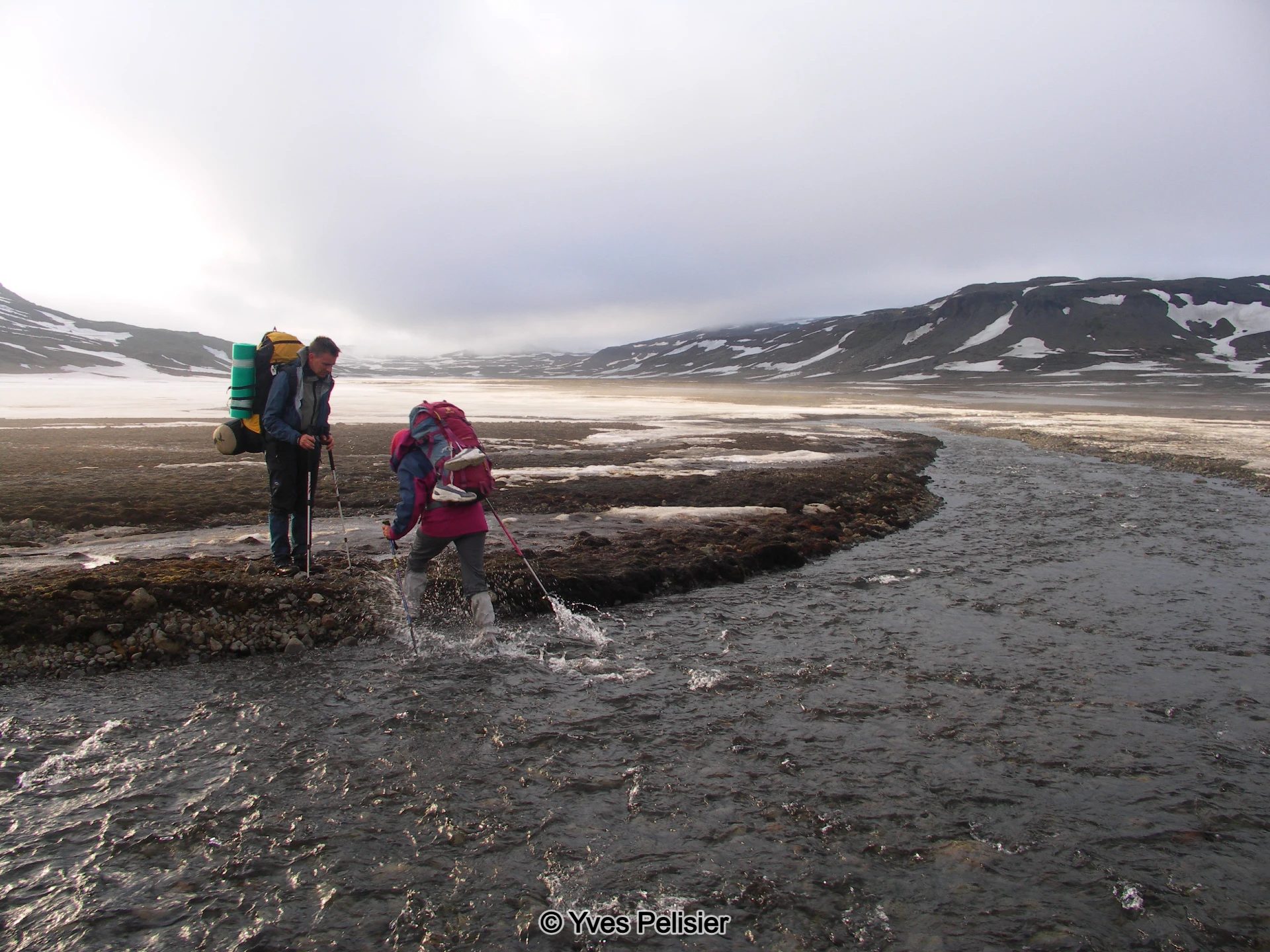
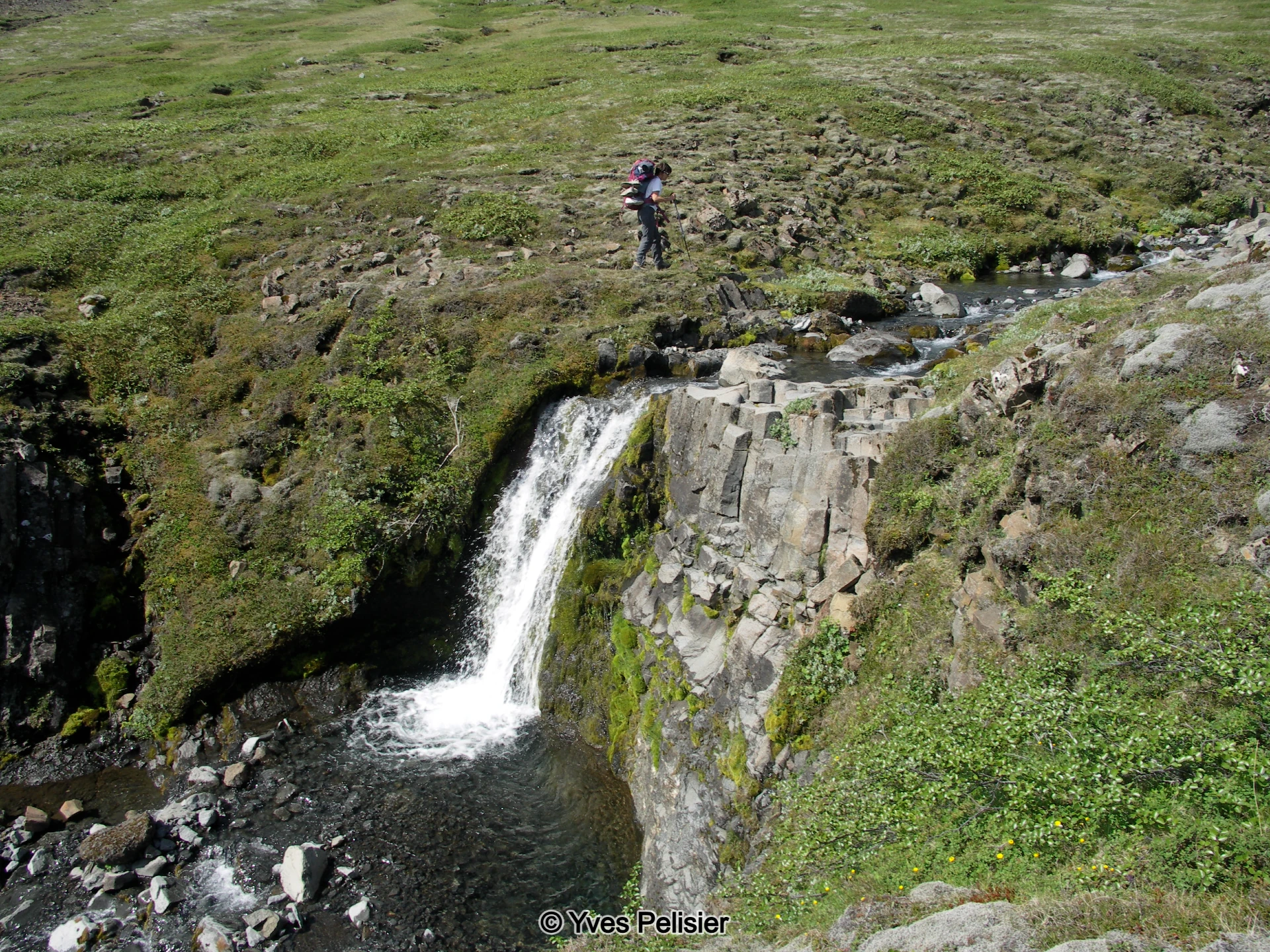
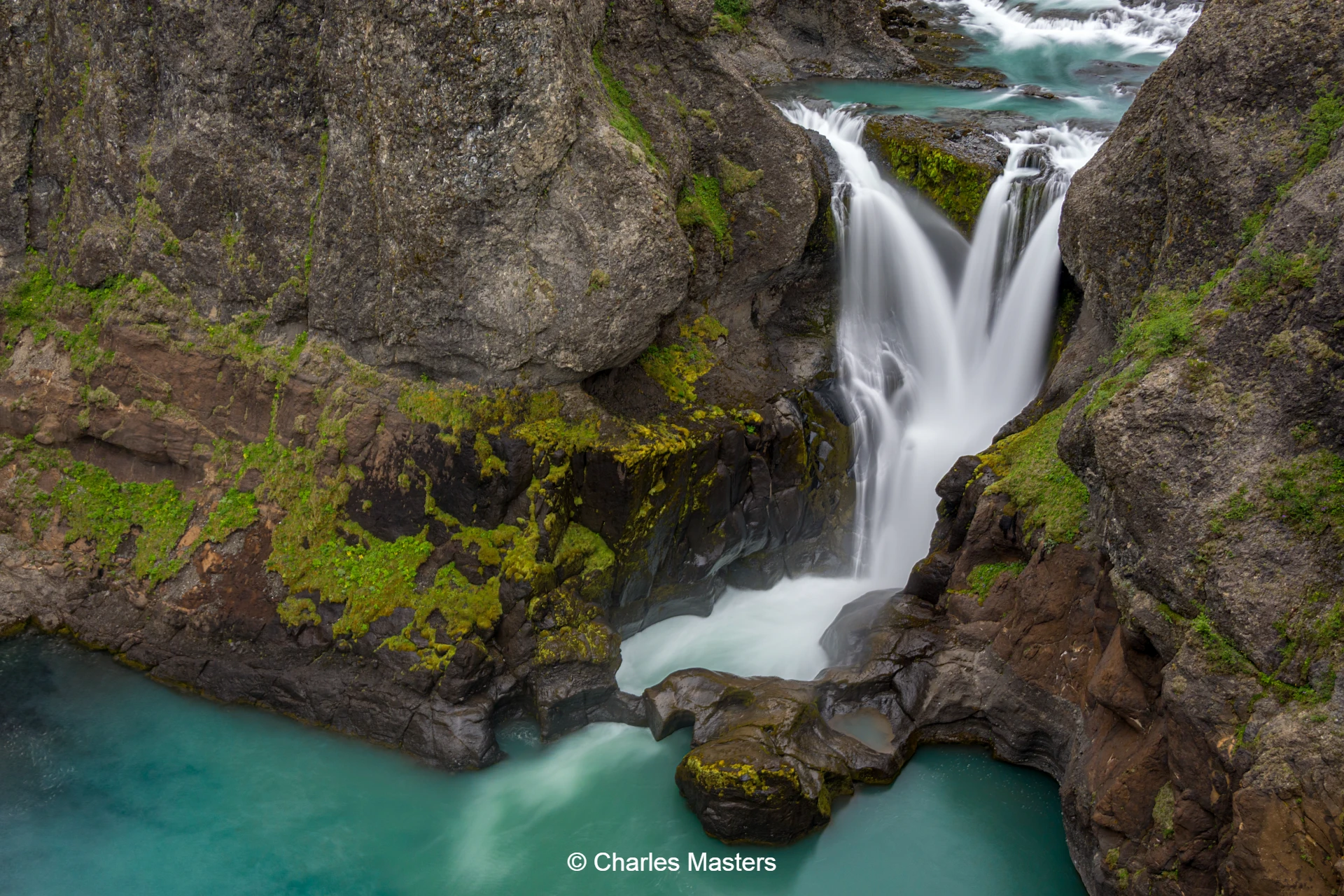
The first day’s walk follows the glacial river Djúpá, which carves through thick layers of lava deposited by past eruptions. Early along the route, the group encounters the first waterfall on Djúpá, as well as picturesque side streams and a small lake. The trail passes the opening of Hrafná canyon and continues to Lambá canyon, where the group camps overnight. If the weather is favourable, there may be an opportunity for an afternoon walk to explore Lambárgljúfur canyon. The day covers 10 km, with a total elevation gain of 150 metres.
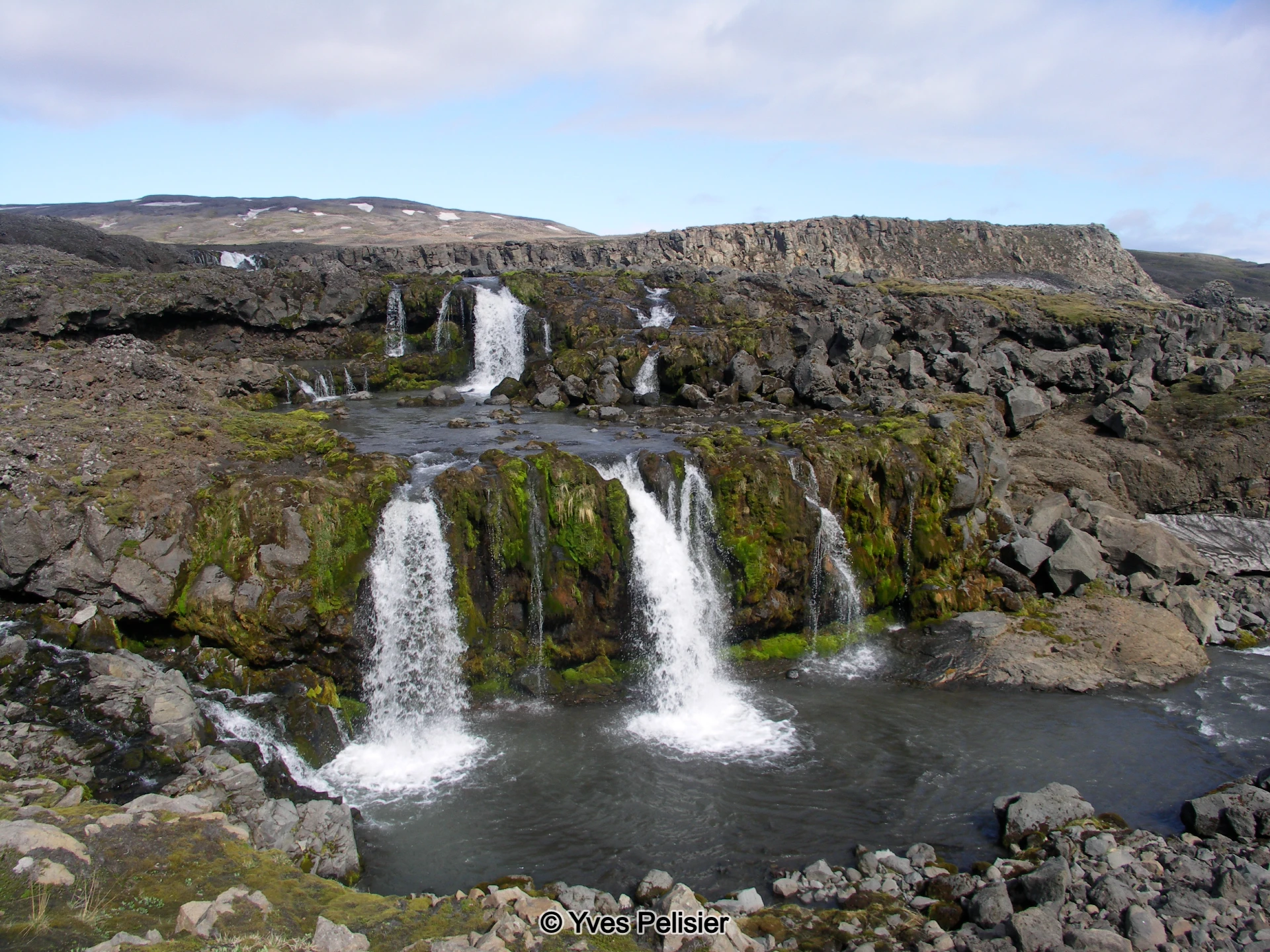
Day 2: Waterfalls and Mountain Views
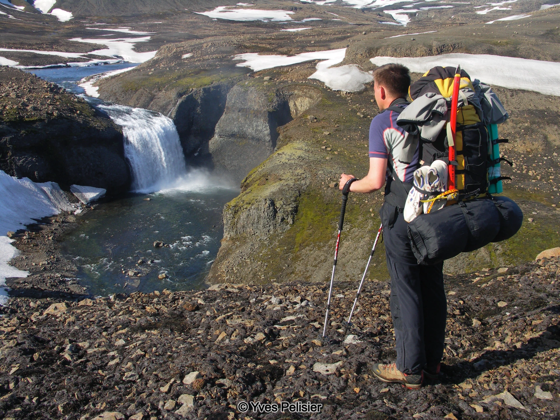
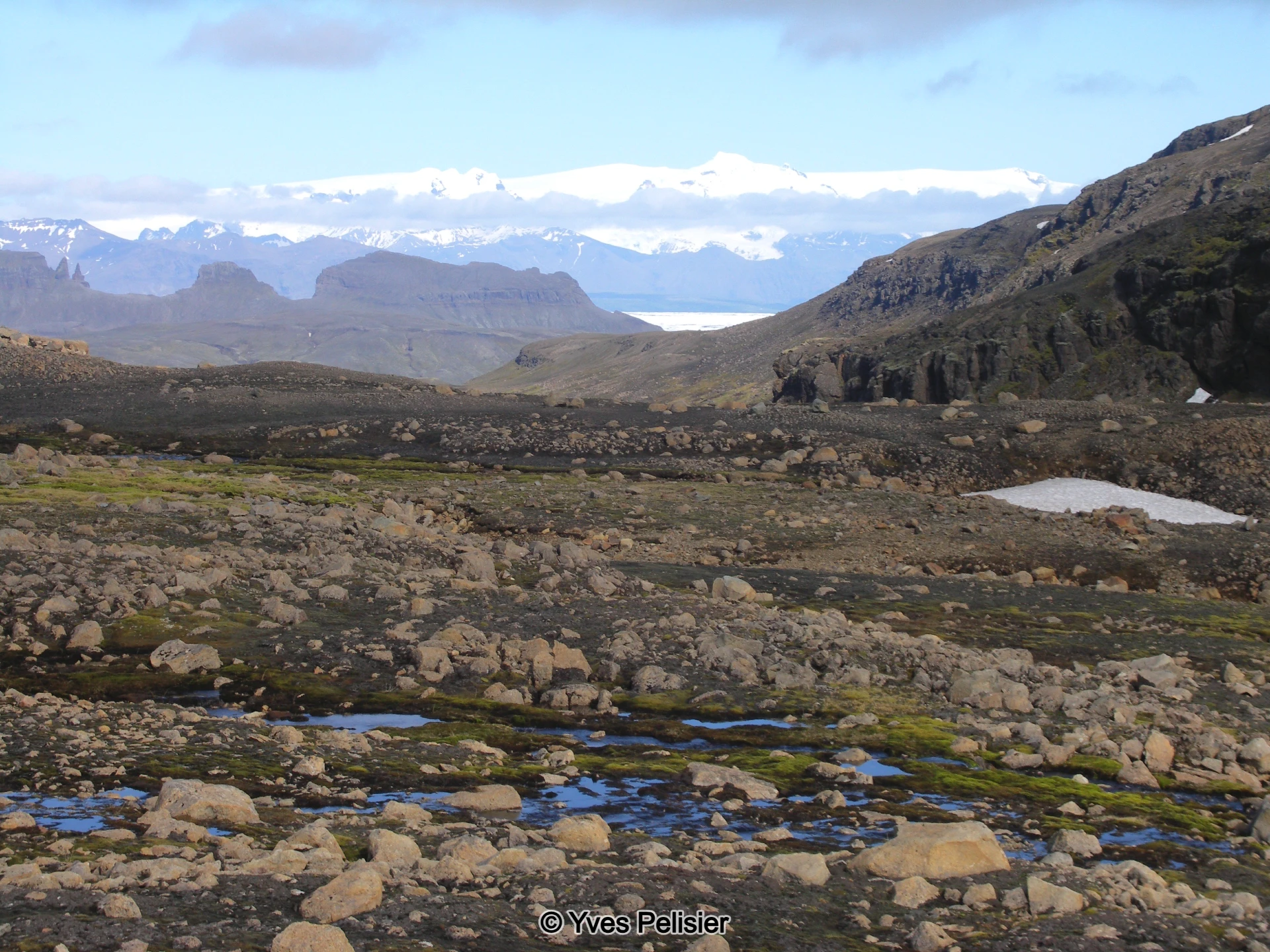
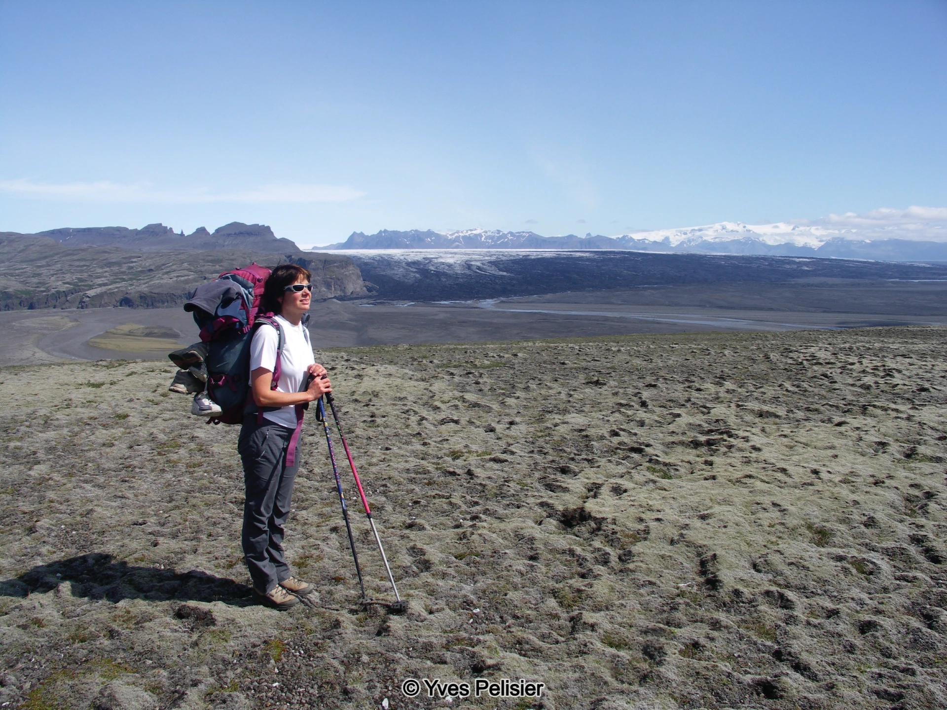
Continuing alongside the Djúpá river, the group reaches the impressive Bassi waterfall before climbing slopes and following a lengthy stretch of rapids. From this vantage point, the mighty Vatnajökull glacier and its outlet glacier, Síðujökull, come into view. The route leads through the hills of Gæsabringur—an area frequented by pink-footed geese in autumn—and concludes at the gorge of Langagil, where camp is set up. The day’s hike is 12 km, with a 300-metre ascent.
Day 3: Gravel Ridges and Lava Fields
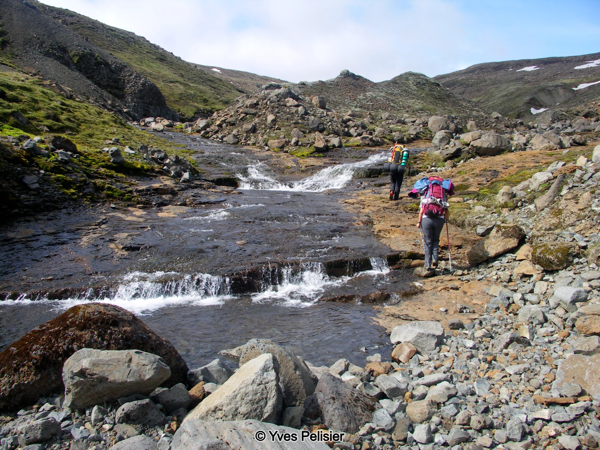
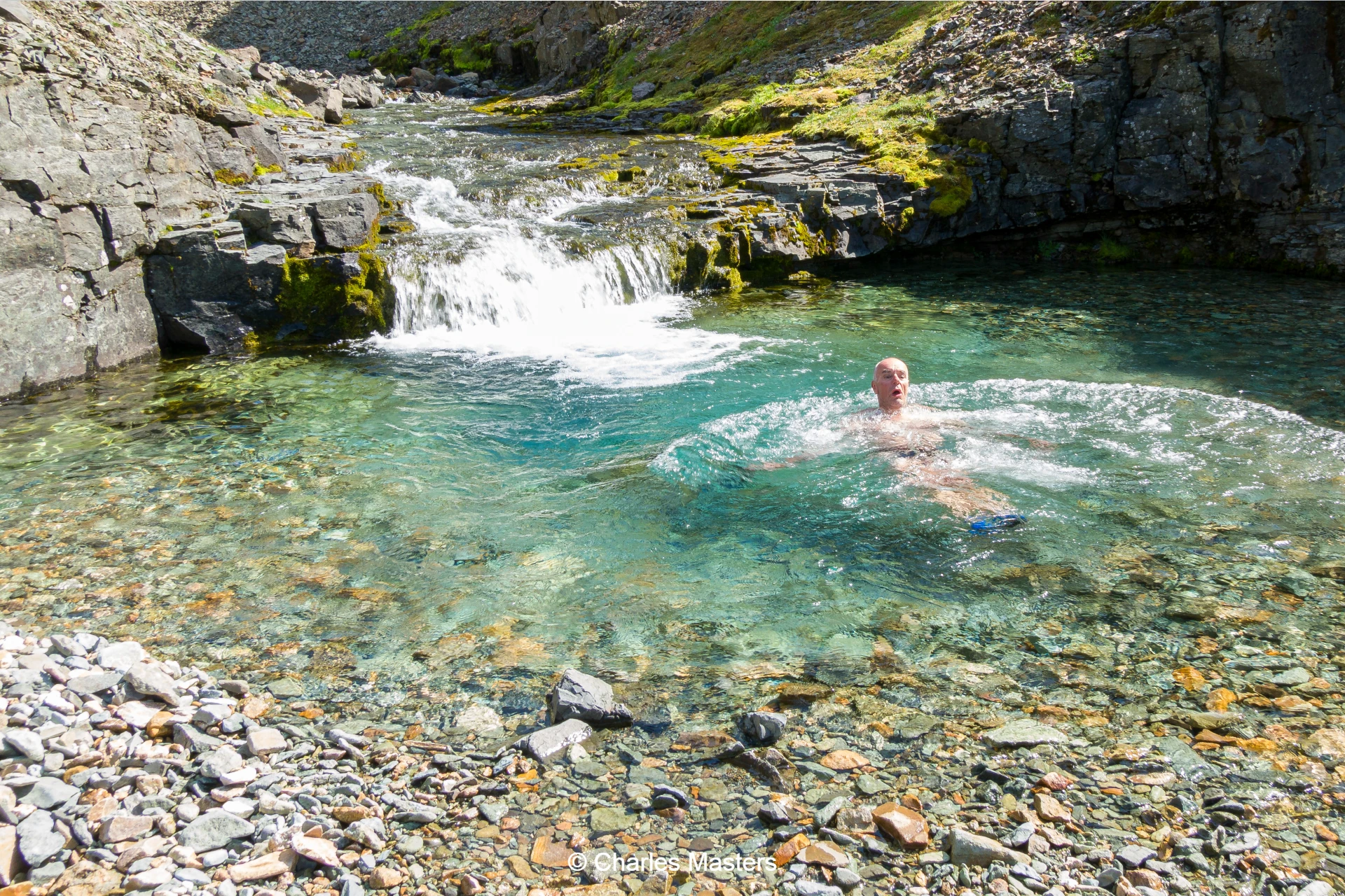
Leaving Langagil, the group ascends the broad gravel ridge of Langasker, offering sweeping views of the main glacier. Landmarks such as Hágöngur mountain enhance the scenery. The walk proceeds towards the striking red crater Eldgígur, then to the glacier's edge, where a small glacier river is crossed. Entering a black lava field, the route descends to a camp nestled at the edge of a crystal-clear spring river, featuring a small hot spring with water at 38°C—perfect for a soothing bath. The day covers 14 km, with a 300-metre ascent and a 200-metre descent.
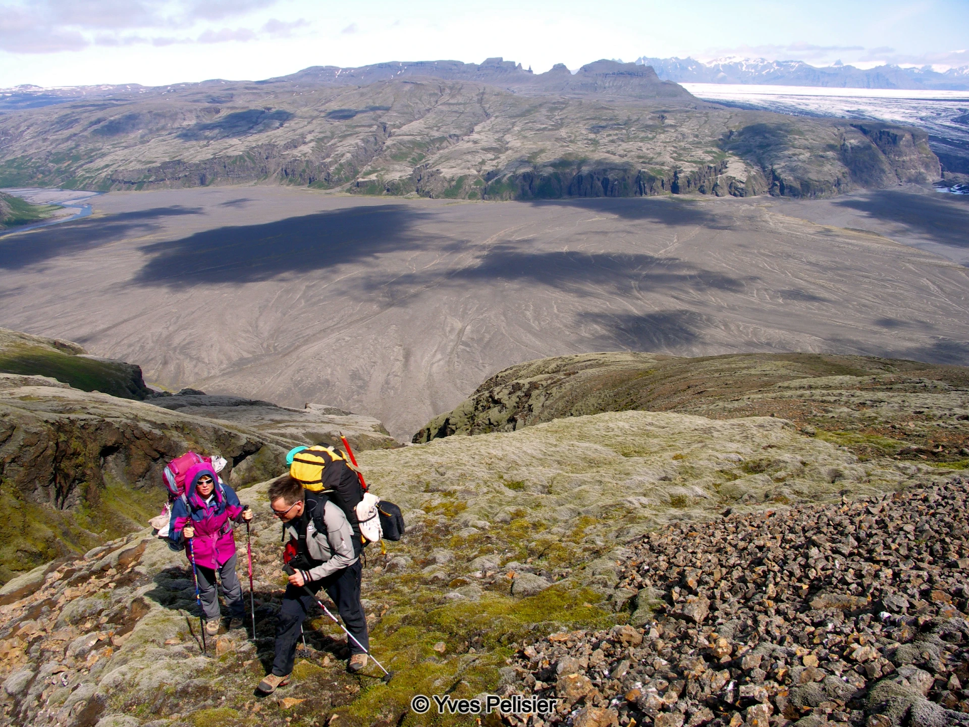
Day 4: Bone Valley and Birch Woods
On the fourth day, the group crosses the Vestari Bergvatnsá river and heads down Bone Valley, following the river’s southern side. The route is adorned with numerous waterfalls and side gullies. A historic lava flow fills sections of the riverbed, providing a unique walking experience. After arriving at the flat area of Hvassvellir, the group descends into the birch woods of Núpstaðarskógar, where farmers once produced charcoal using ancient methods. The final camp is set amidst the valley’s lush vegetation. The day’s walk is 12 km, with a 200-metre ascent and 400-metre descent.
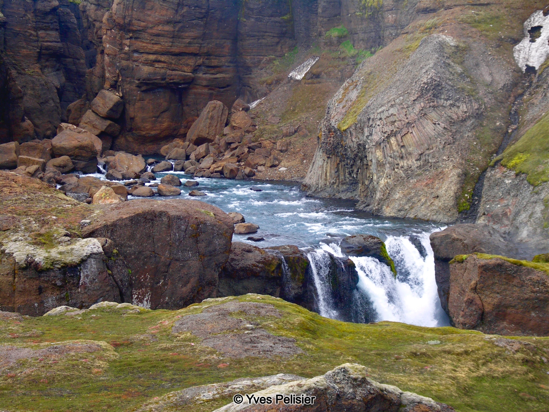
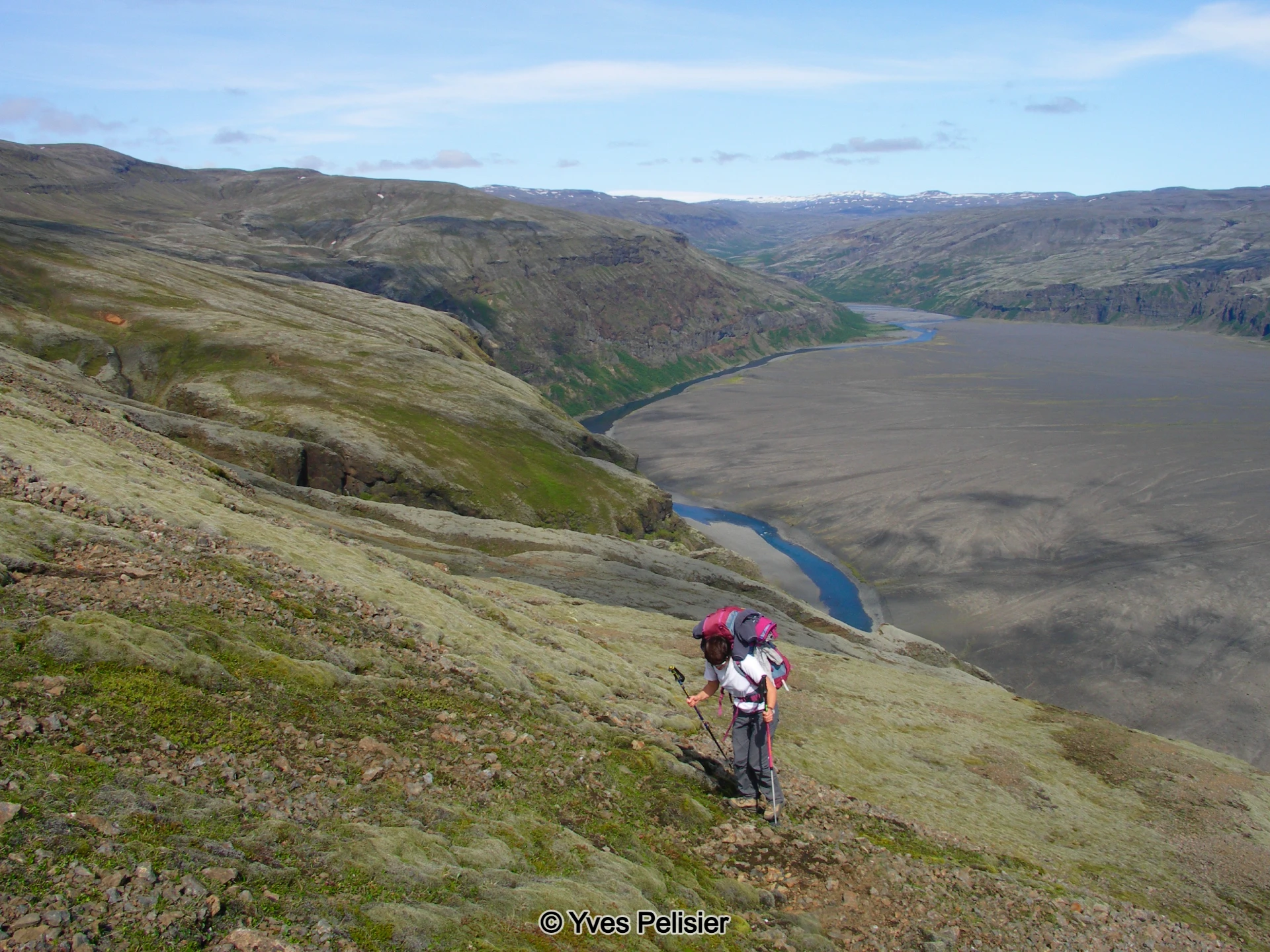
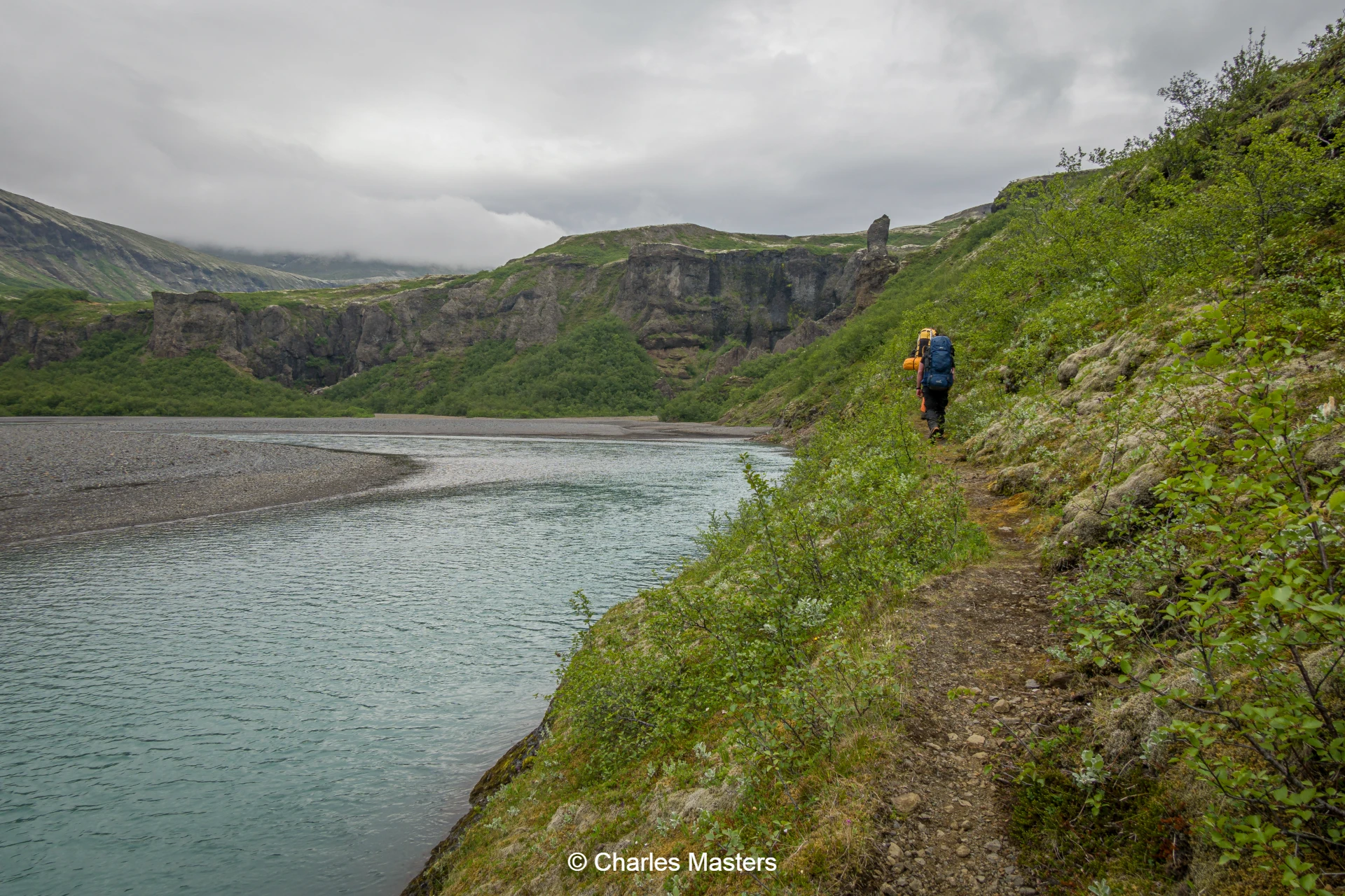
Day 5: Hvítá River Canyon and Lómagnúpur Mountain
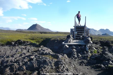
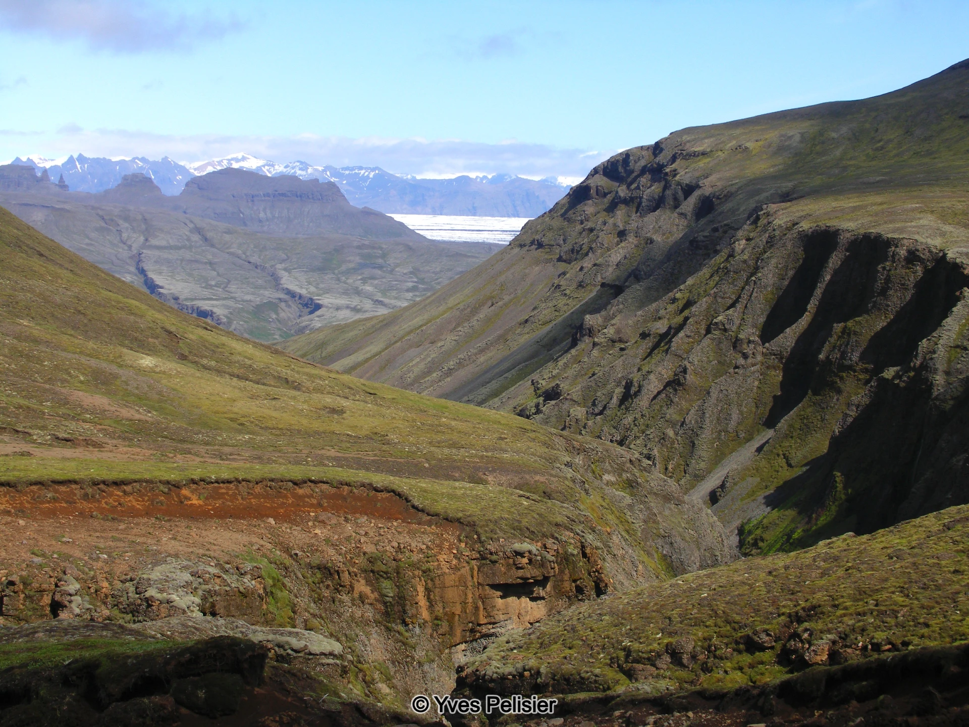
The group leaving the birch forest, ascending along the impressive Hvítá river canyon and passing several waterfalls and rivers. The route reaches the shoulder of Hvirfildalur valley before descending to the flank of Lómagnúpur mountain—the rhyolite giant with sheer vertical cliffs. At the mountain’s end, the group joins the main road, where a vehicle awaits to transport everyone back to Kirkjubæjarklaustur where we spend the night. This concluding stretch covers 16 km, with a 200-metre ascent and 400-metre descent.
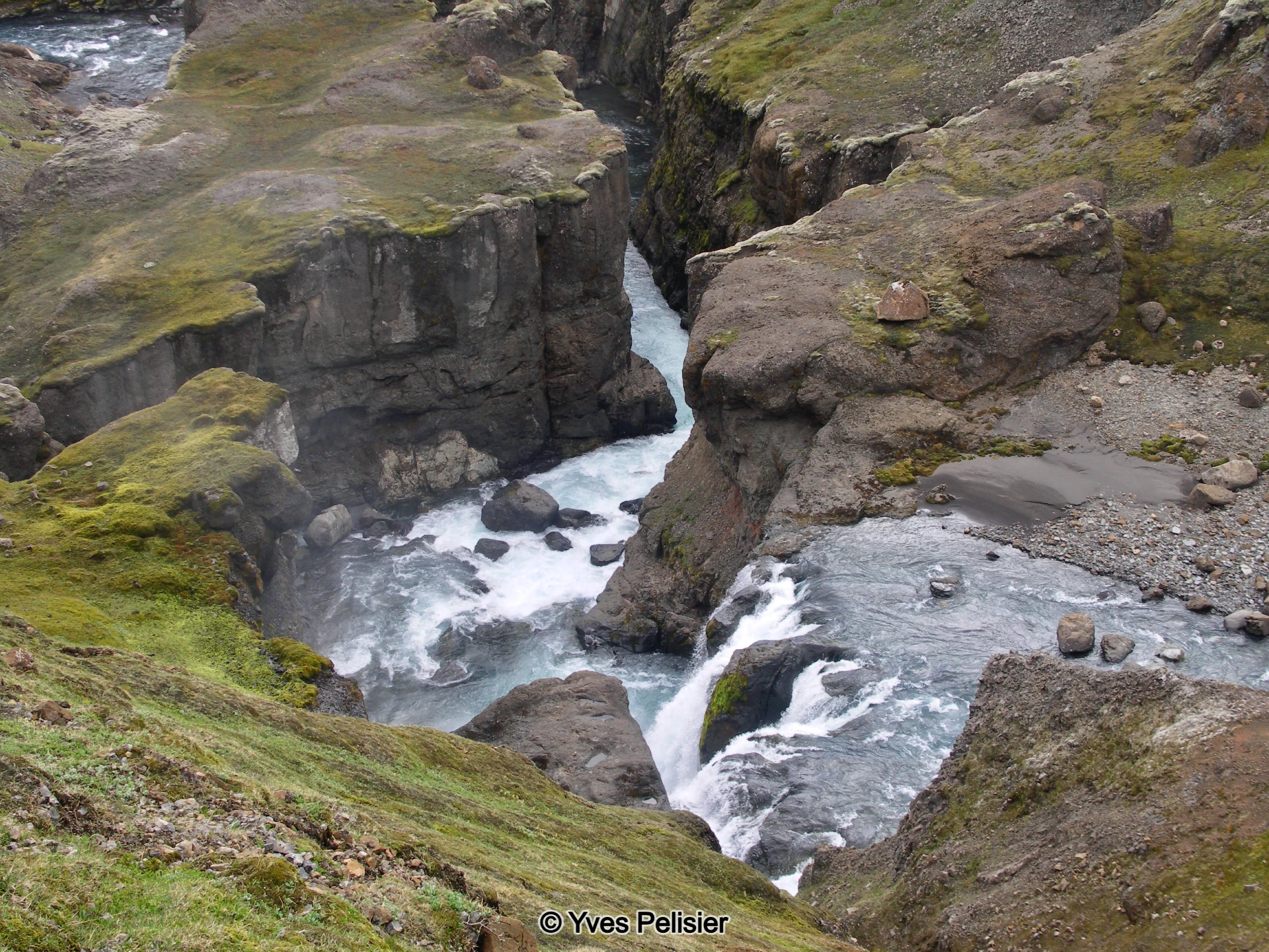
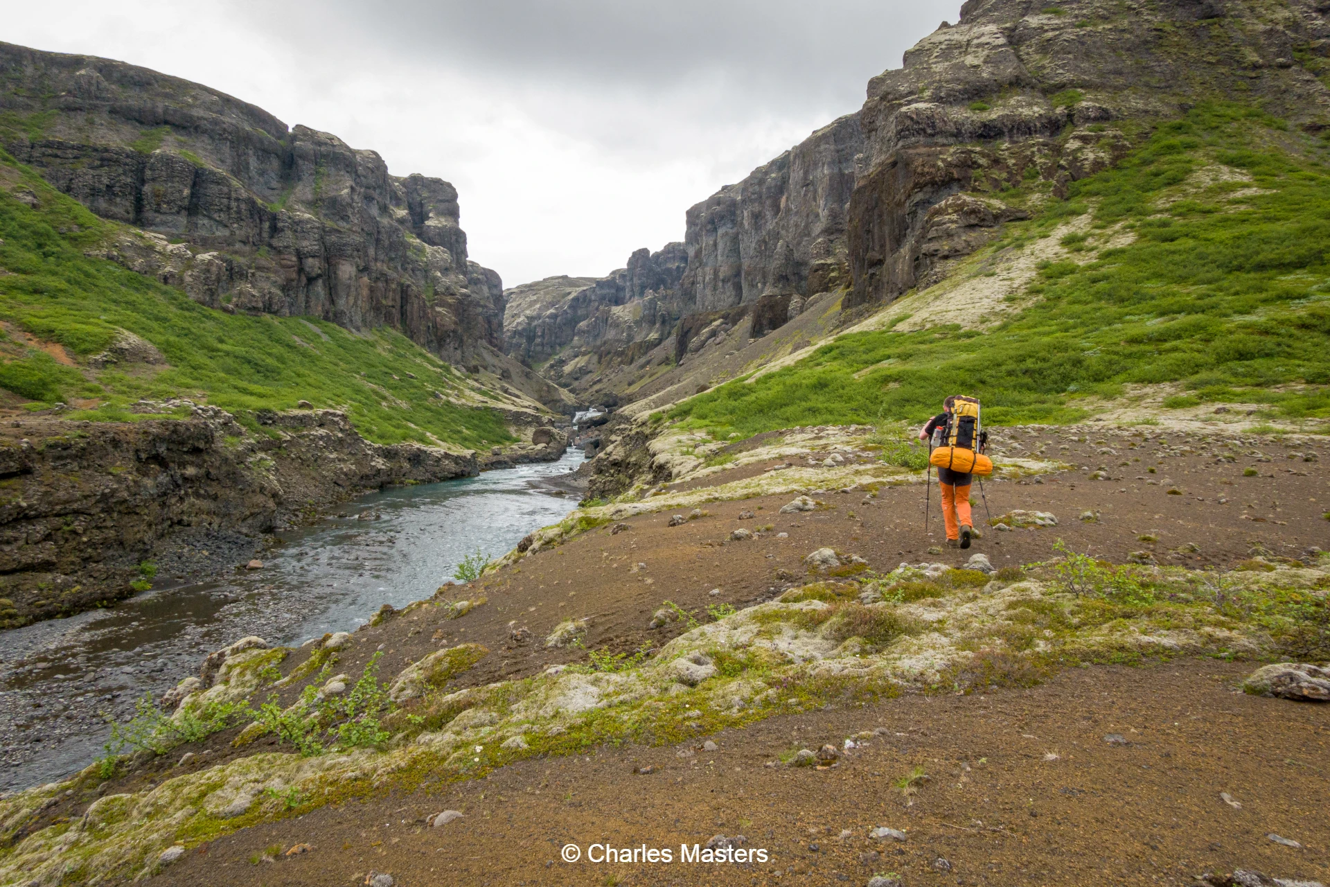
Day 6: Núpsstaðarskógar Valley to Sléttur
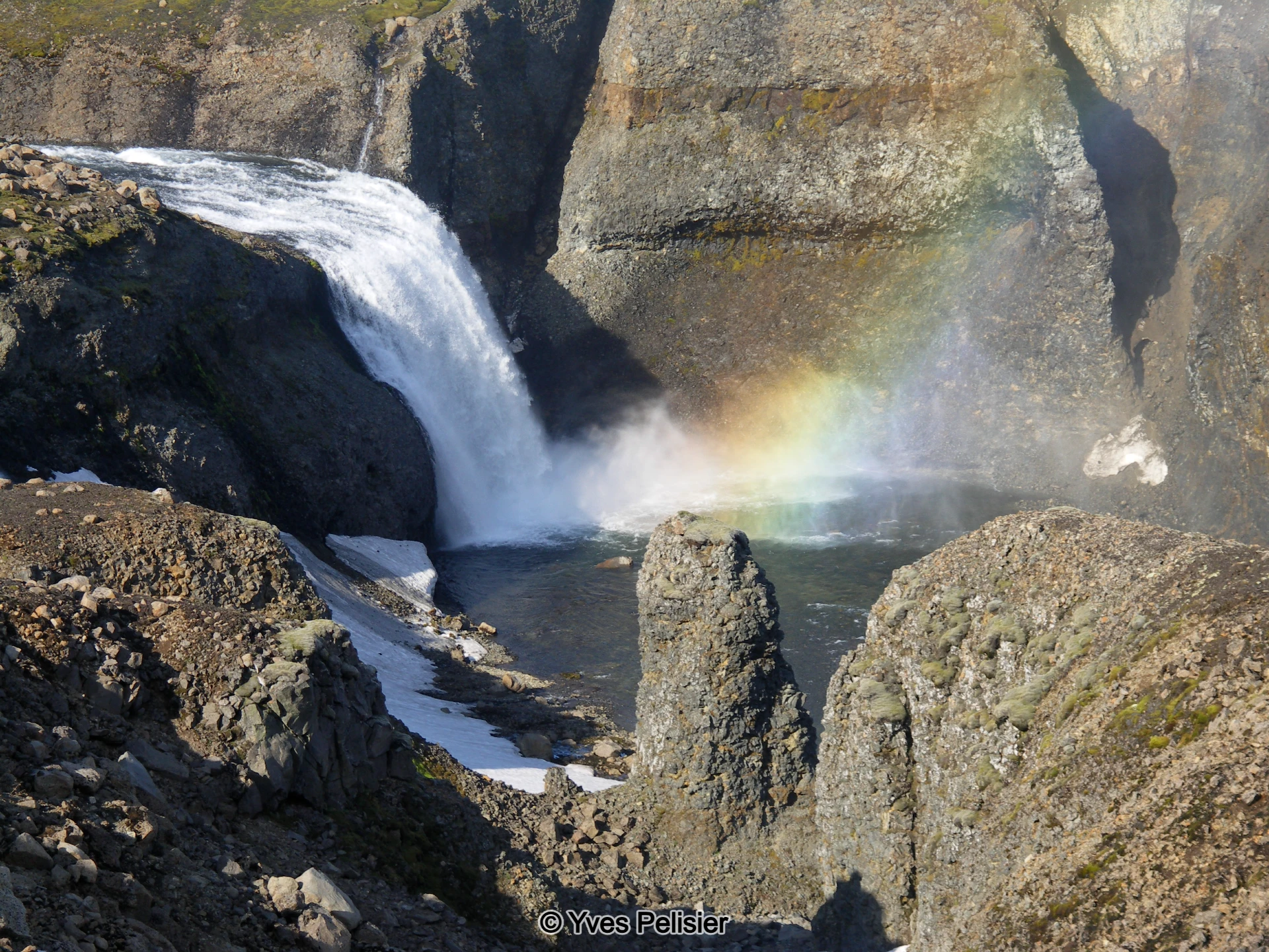
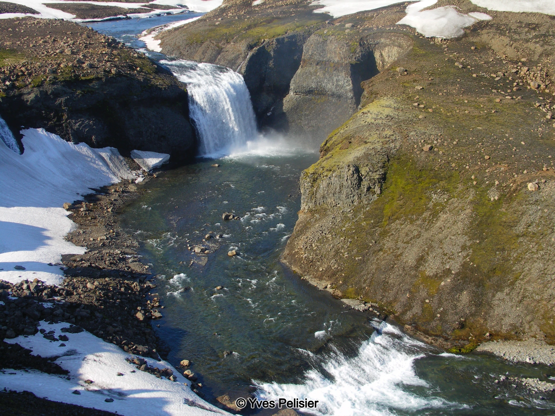
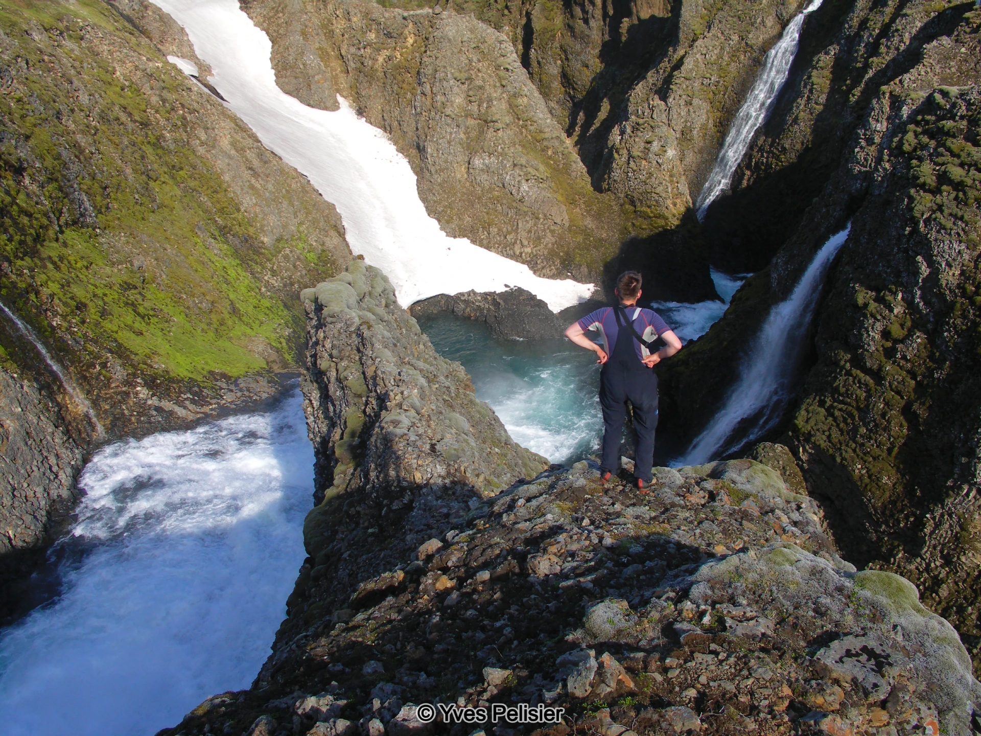
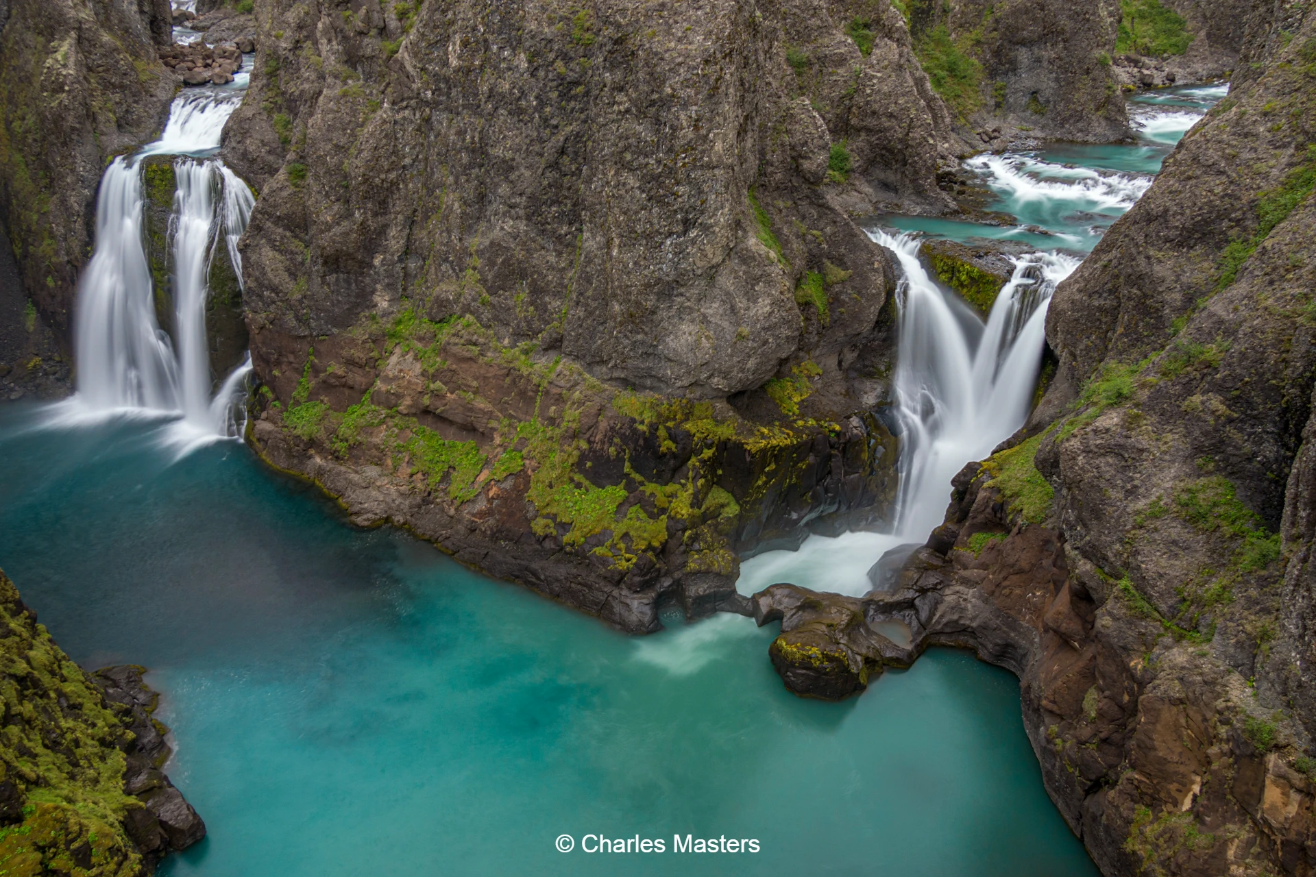
After breakfast a transport vehicle takes us to the entrance to the Núpsstaðarskógar valley, with the route tracing impressive cliffs and winding through dramatic side canyons. The group undertakes a 10-metre rock climb, assisted by a chain and rope for safety, leading to the striking double waterfall of Tvílitihylur, where two falls merge into a single powerful river.
Following the Núpsá river to another waterfall, the path then ascends a steep gulley, reaching the high plateau of Sléttur. Here, remarkable lava pillow formations await. The day concludes with an overnight camp at Sléttur after a seven-hour, 12-kilometre walk.
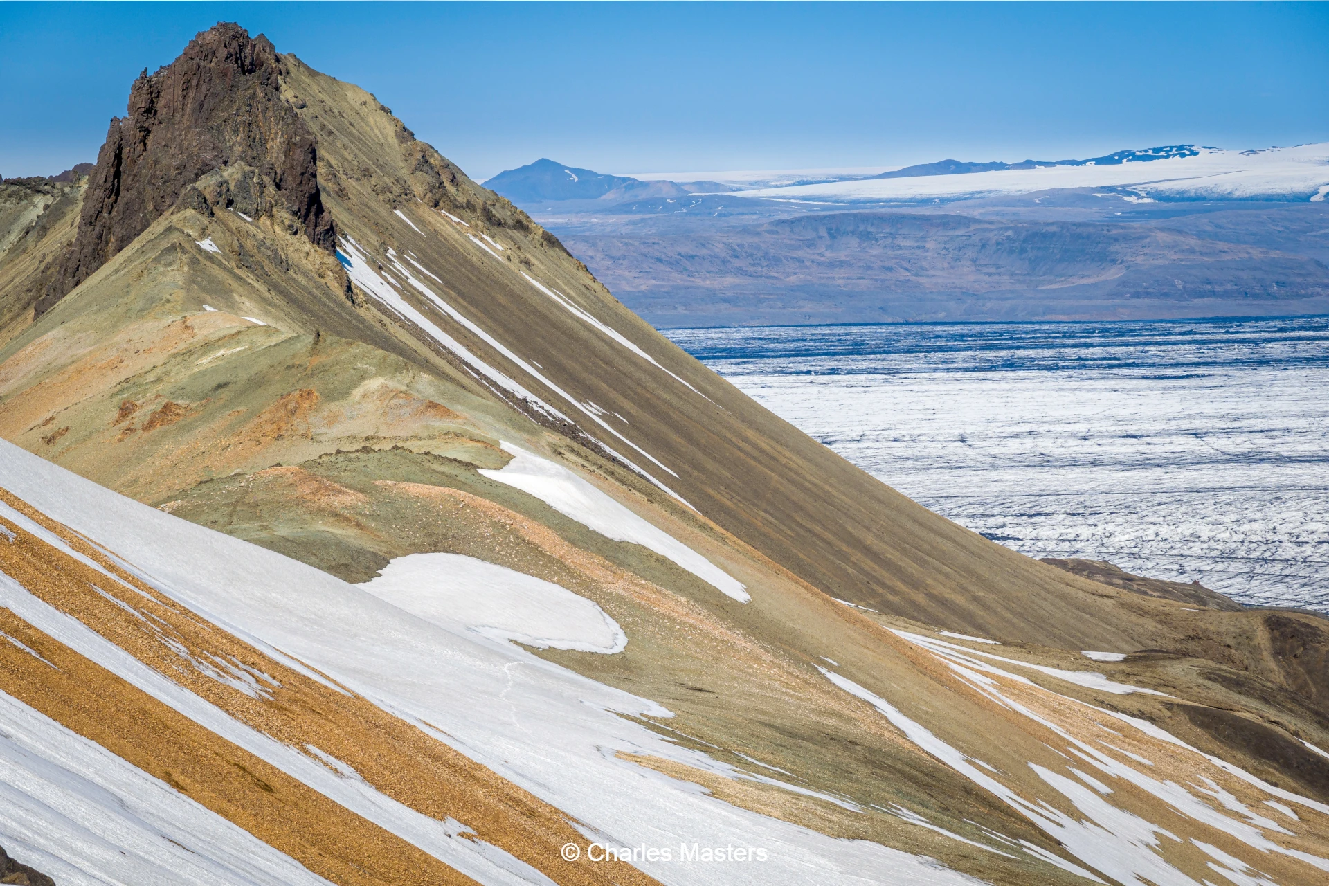
Day 7: Sléttur to the Edge of Skeiðarárjökull
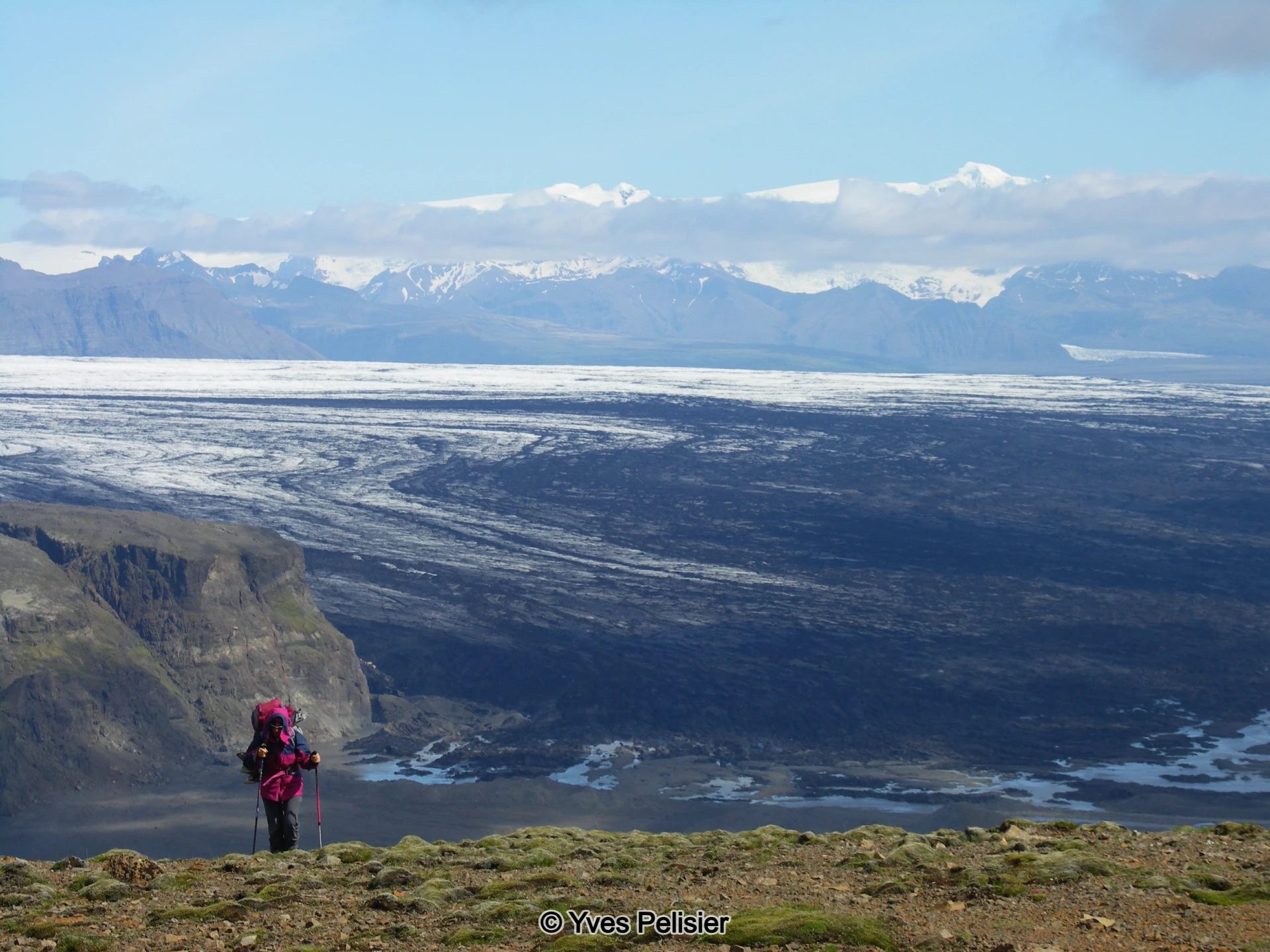
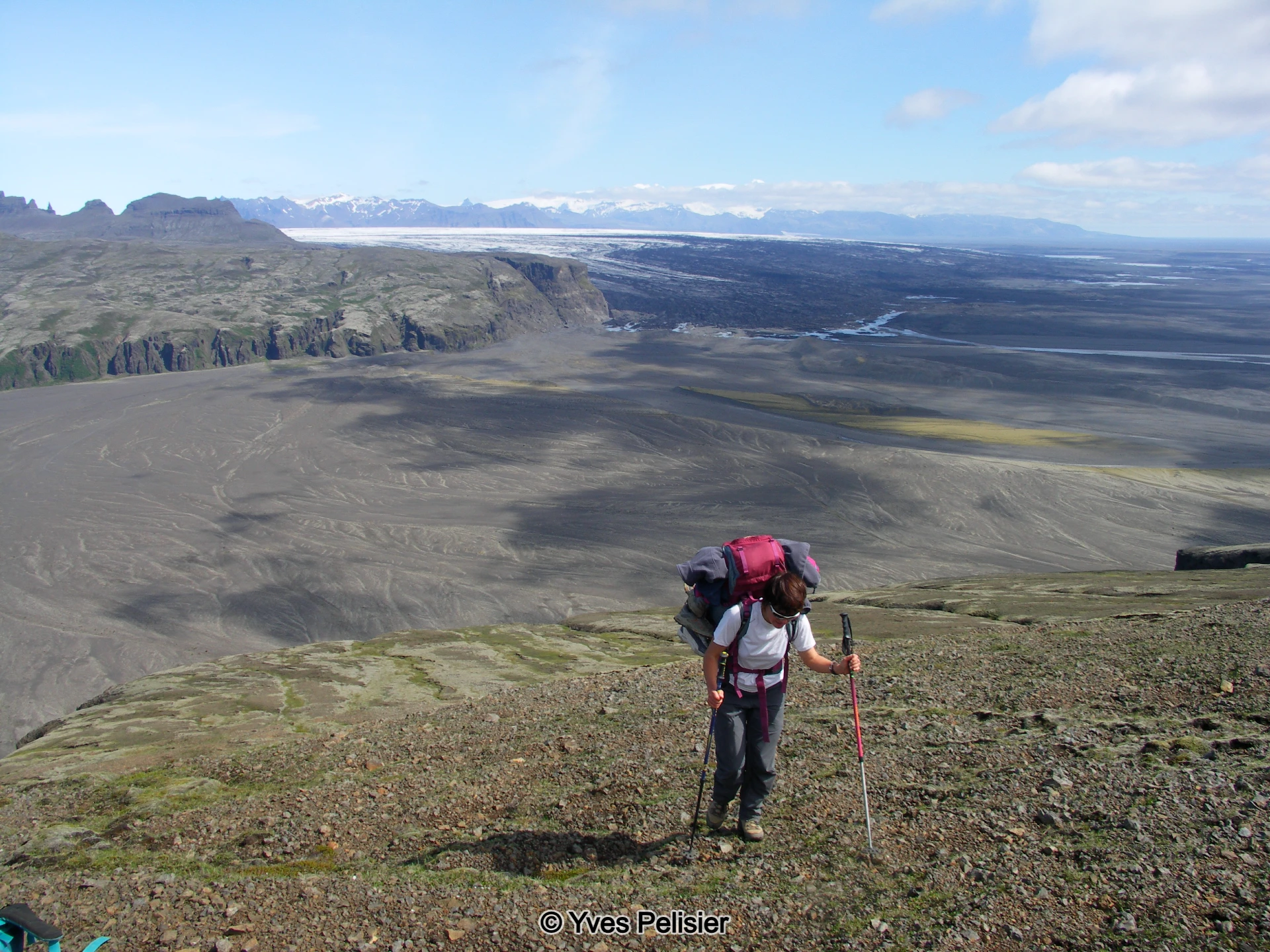
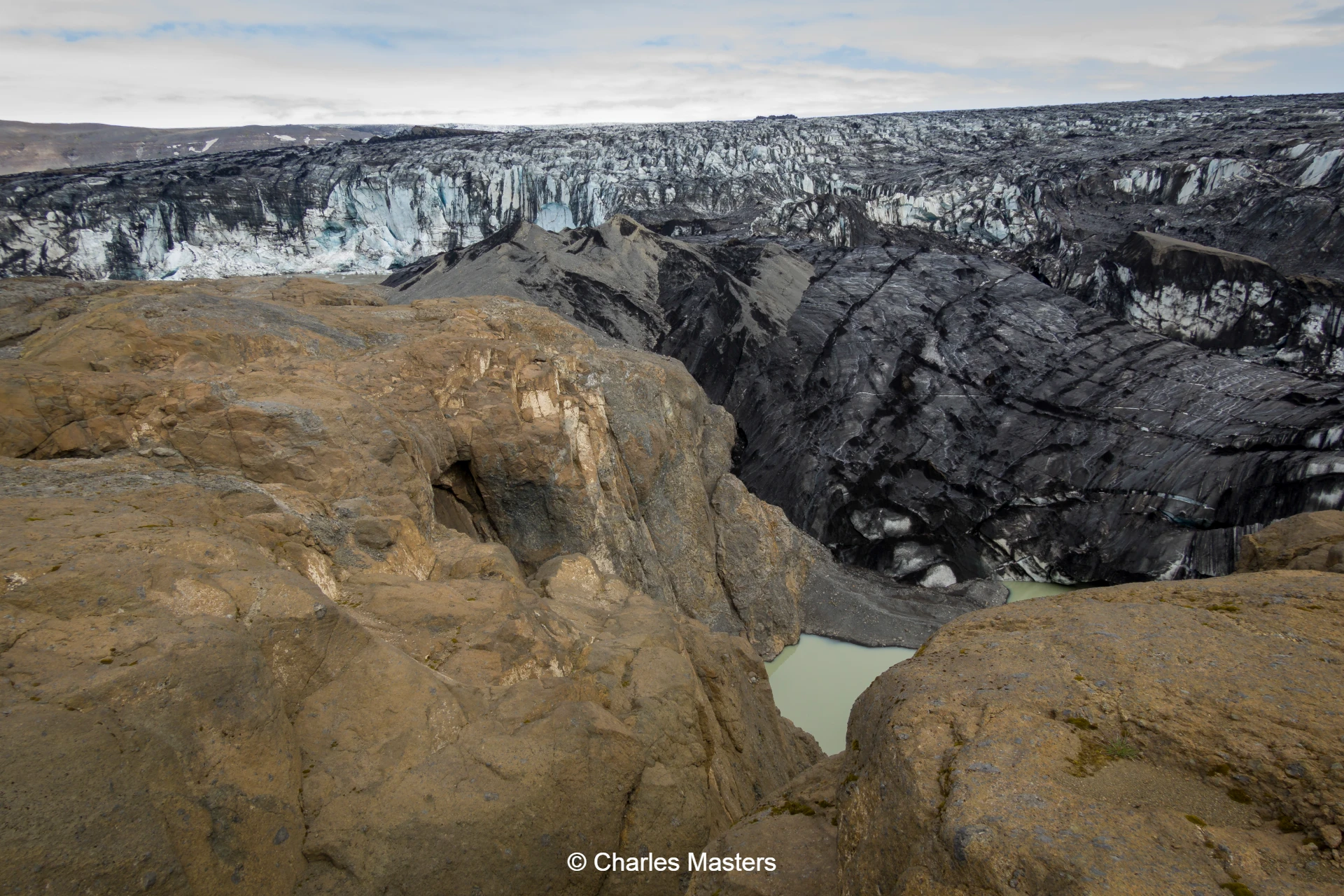
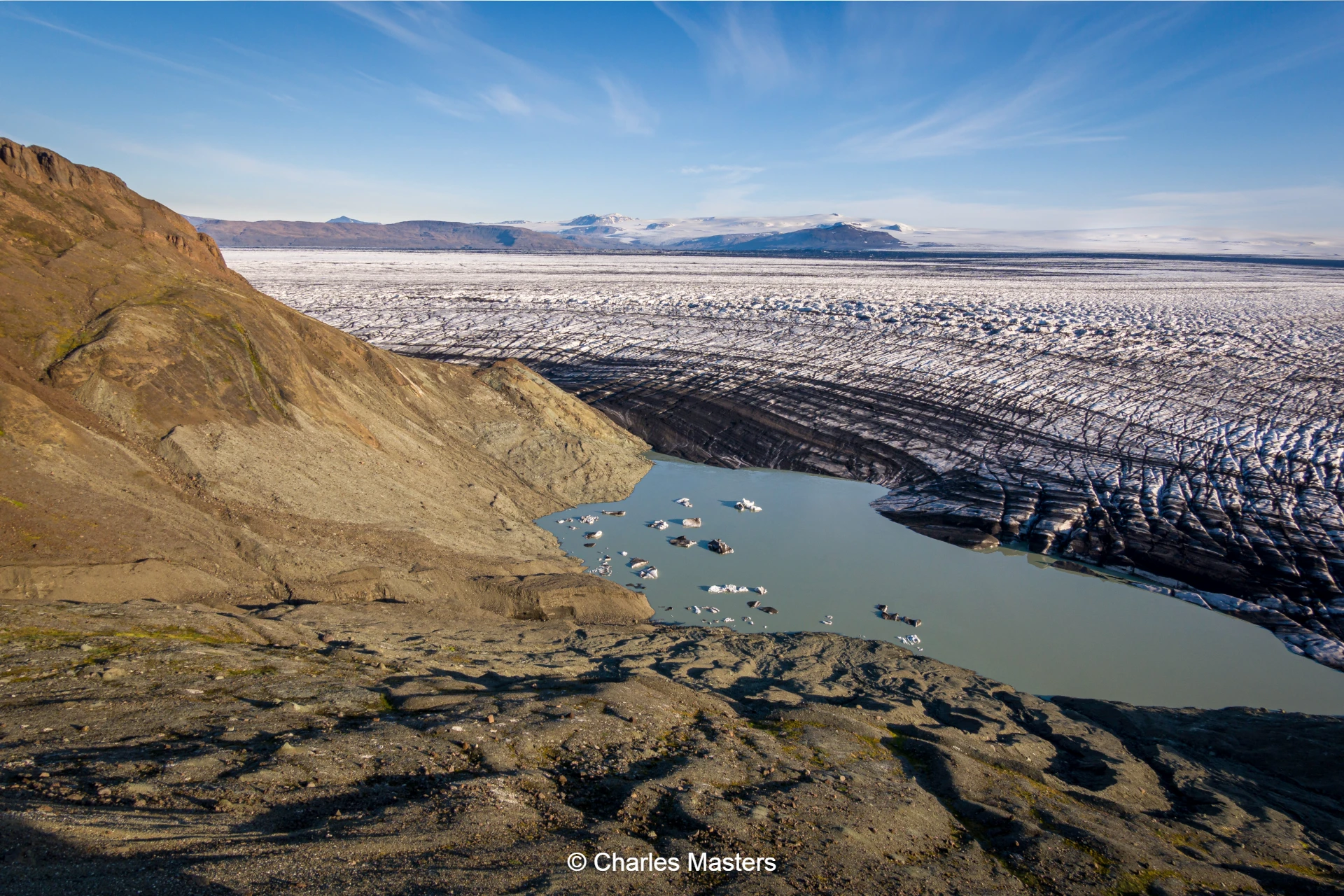
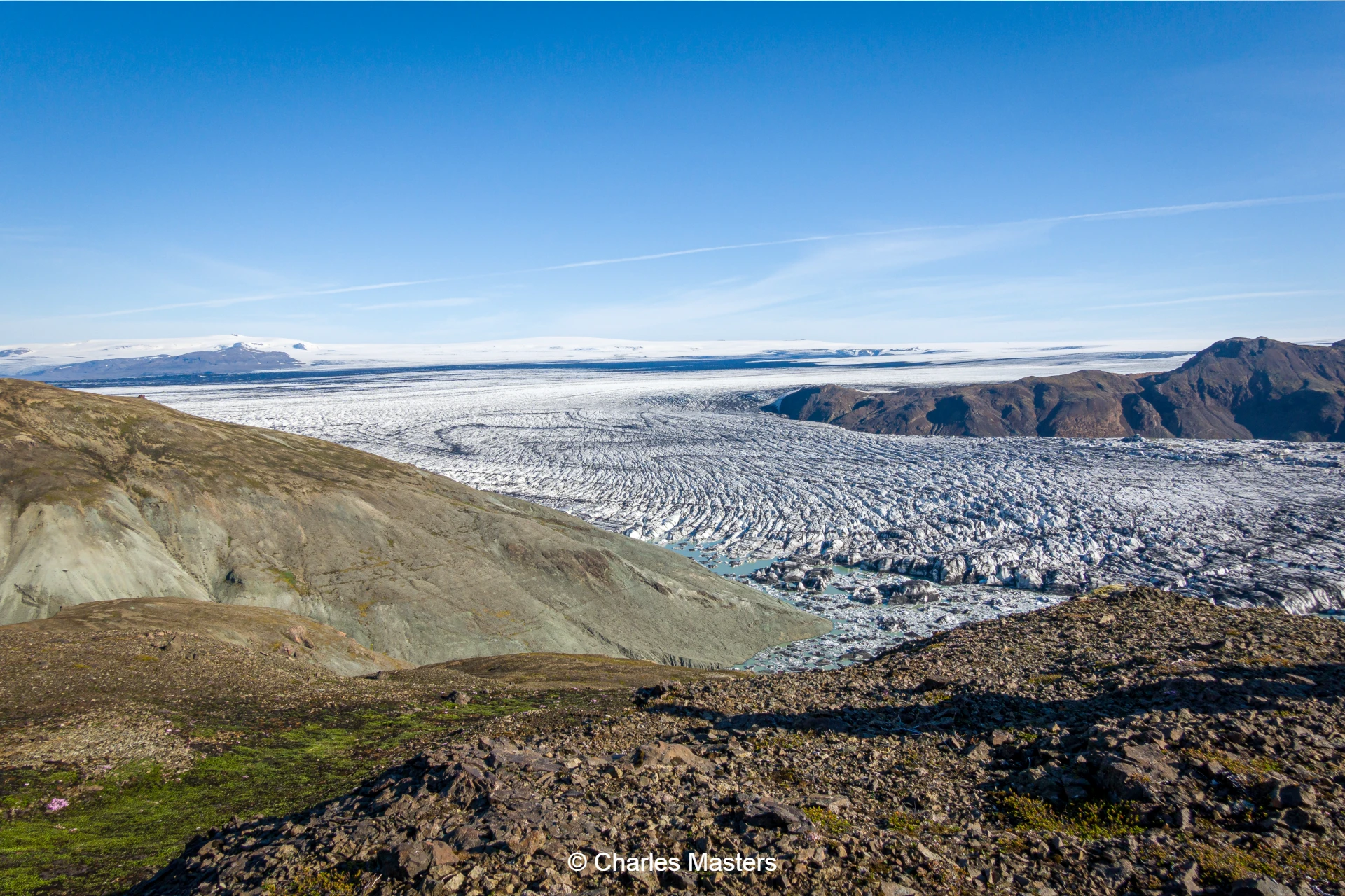
The second day offers a shorter hike, allowing ample time to appreciate the region’s natural beauty. The morning features an ascent to the summit of Eggjar, granting panoramic views over Skeiðarárjökull, Iceland’s largest glacier outlet, which covers nearly 600 square kilometres.
The group establishes camp at the glacier’s edge and explores both the glacier’s periphery and the remnants of the once expansive Grænalón lake. This day involves a walk of five to six hours, covering 12 kilometres.
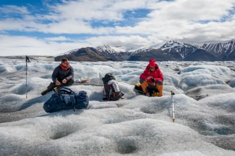
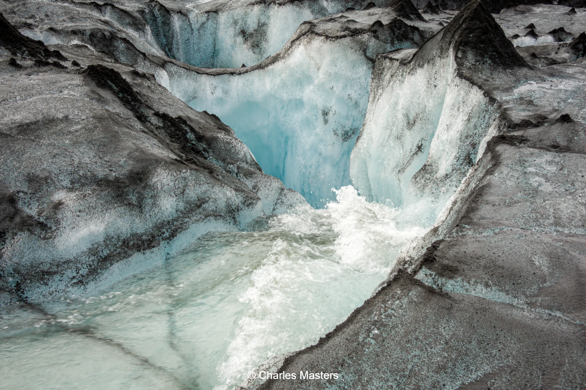
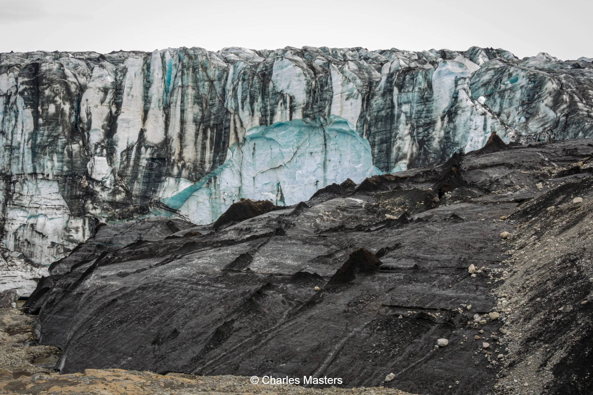
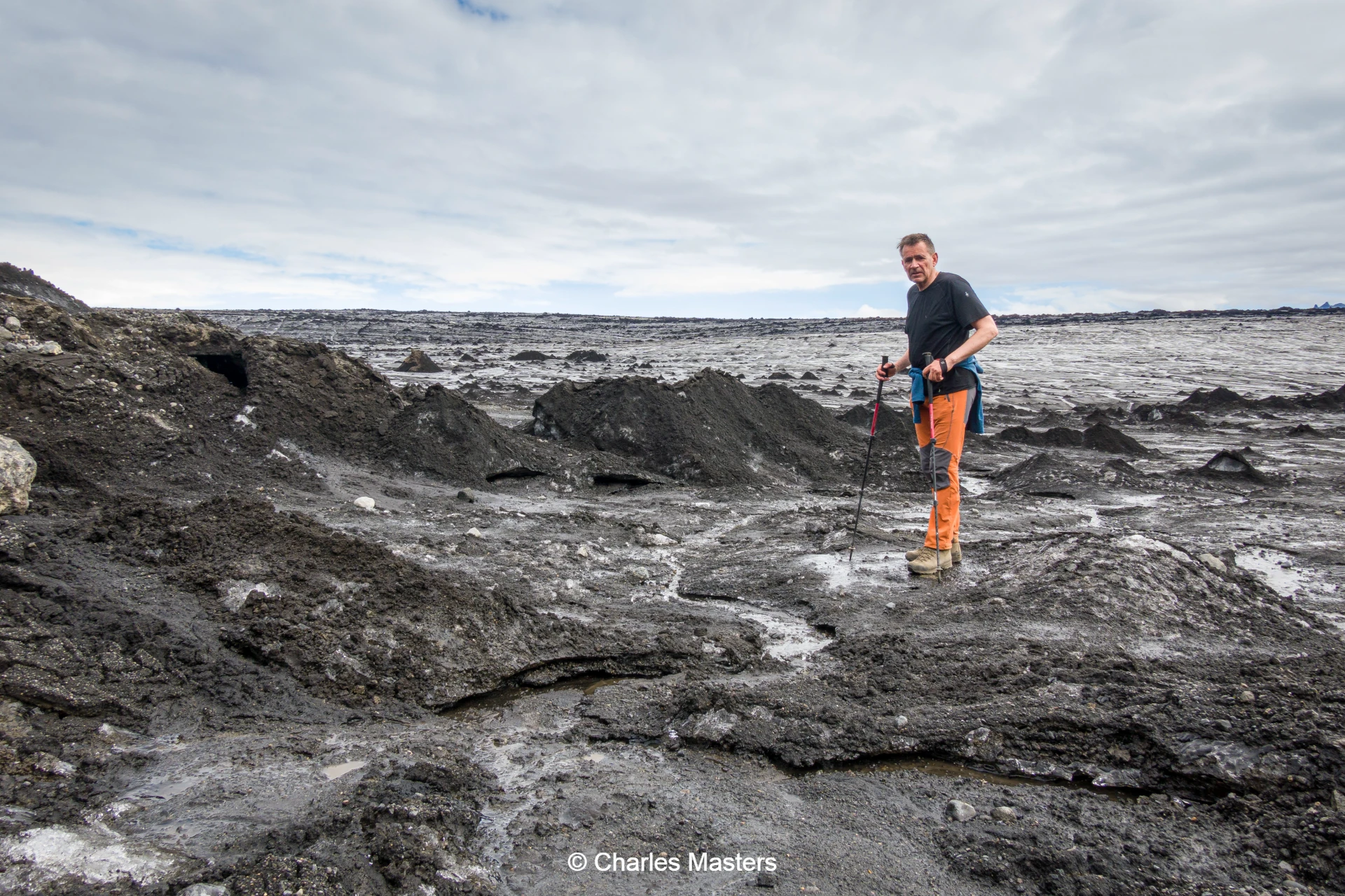
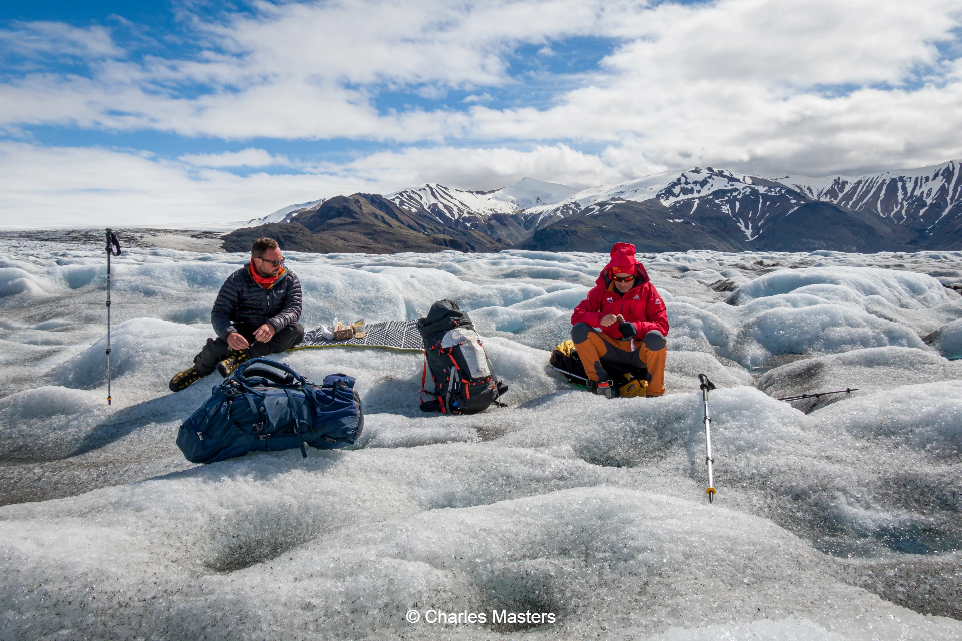
Day 8: Crossing the Glacier
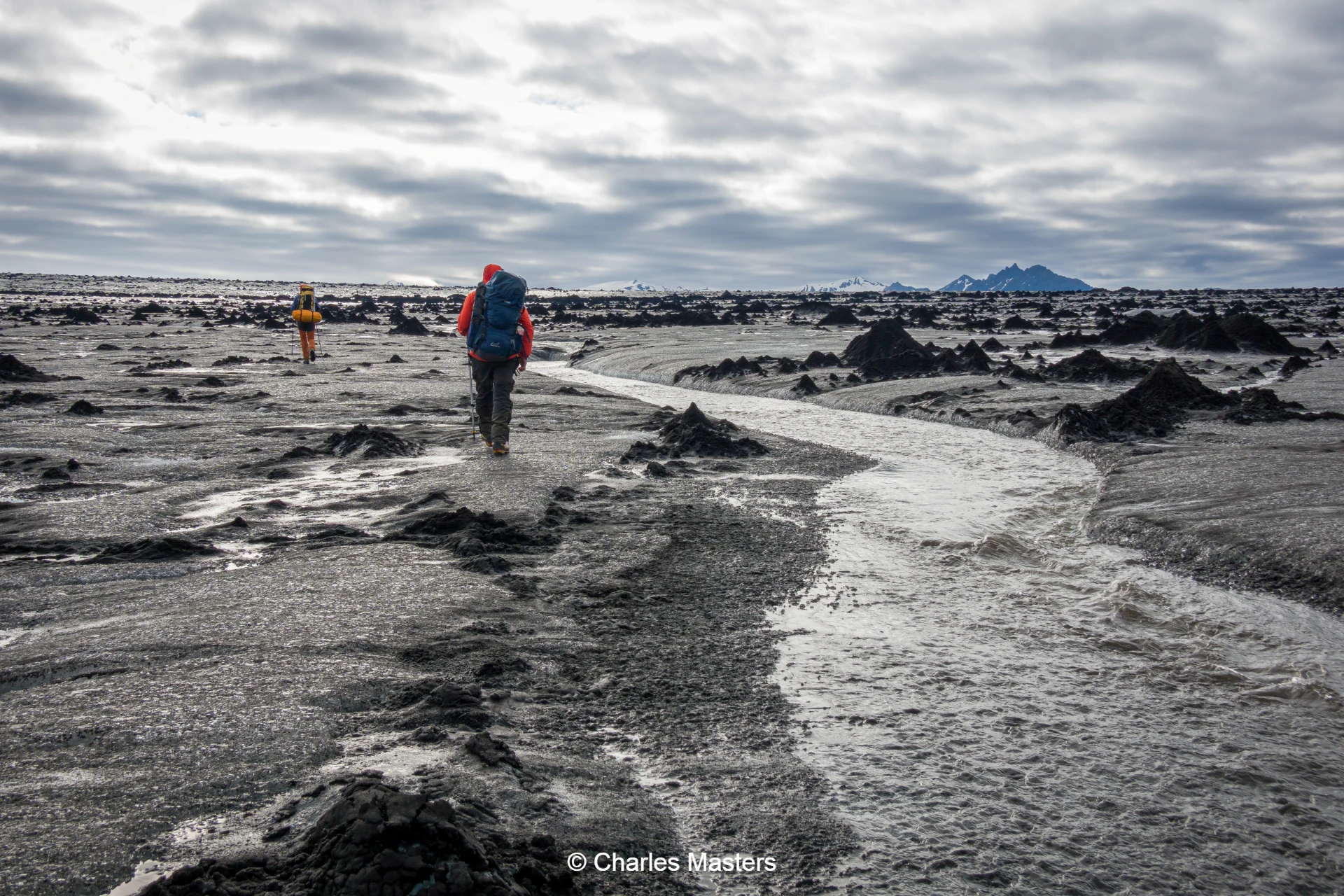
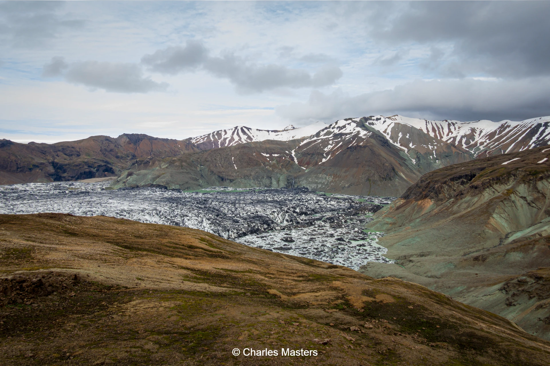
On the third day, the highlight is the glacier crossing. After selecting a suitable place to access the ice, the group heads east across a surprisingly diverse landscape of creeks, streams, ice pyramids, and stretches of black volcanic sand. Progressing further eastward, large water cauldrons and broader streams appear, which are crossed with relative ease.
After about 10 kilometres, the group enters Norðurdalur—a valley dominated by ice—and carefully navigates around several crevasses before reaching solid ground. The day ends with camping at 'the Balcony', renowned as one of the world’s most spectacular campsites and offering superb views of the route just completed. This challenging day involves an eight-hour, 16-kilometre walk.
Day 9: The Balcony to Skaftafell
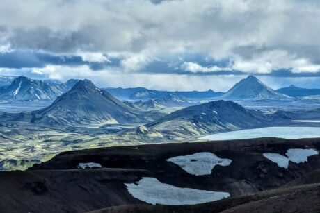
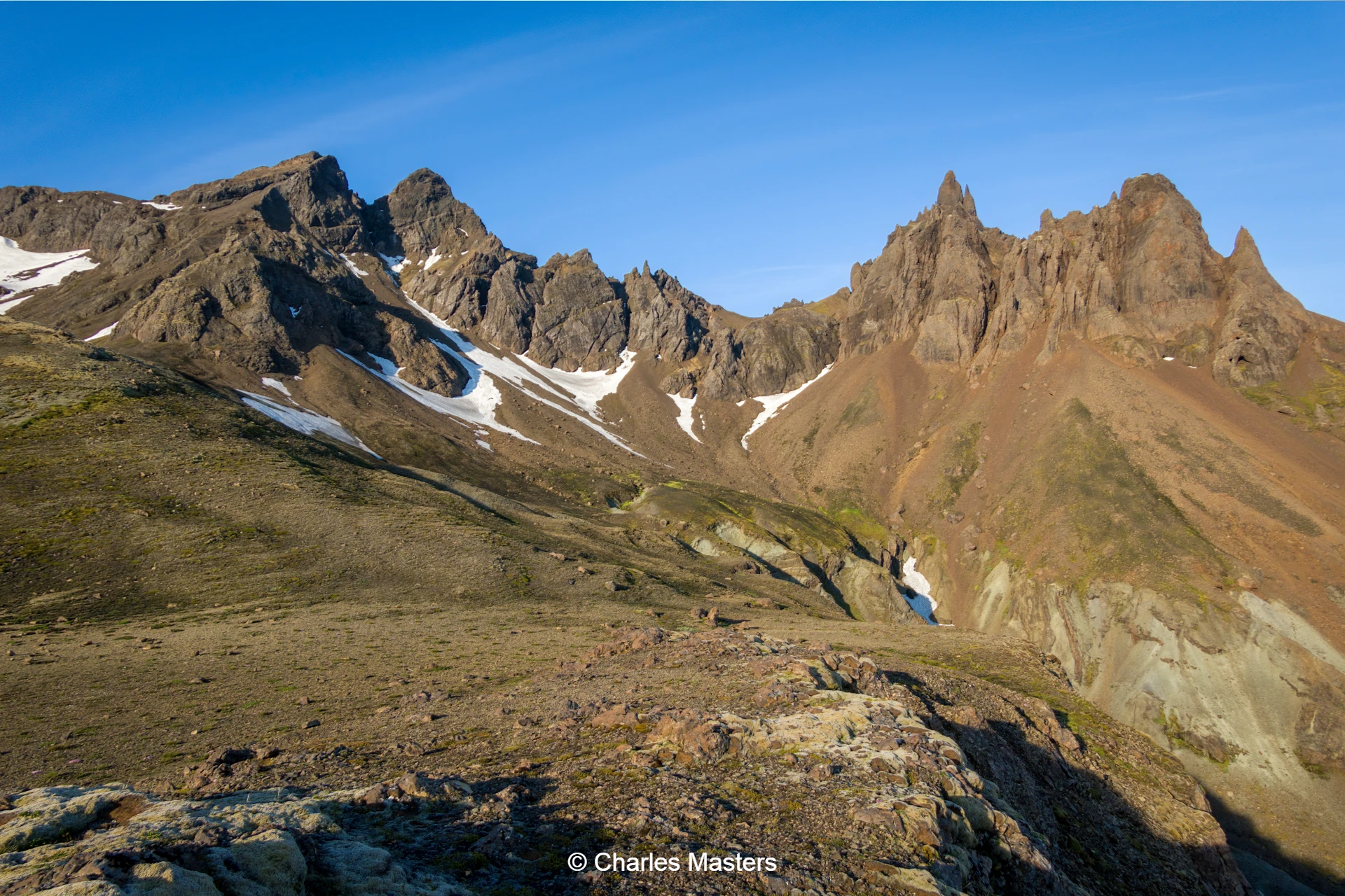
The final day begins with a climb along a narrow trail bordering the screes of Færneseggjar, ascending to a pass on the Kjósareggjar ridge. The scenery is breathtaking, boasting colourful rhyolite mountains, glacier-filled valleys, and sharp summits. From the 1,150-metre-high pass, the group enjoys vistas of Iceland’s highest peak, Hvannadalshnúkur, and the formidable Öræfajökul volcano.
The descent leads through a verdant valley adorned with a series of waterfalls, continues into the birch forest of Bæjarstaðarskógur, and finally crosses the black sands of Morsárdalur, concluding the journey at Skaftafell. This last section involves an eight-hour walk covering 16 kilometres.
Included in price :
Guiding, all necessary permits and fees, camping equiment (except sleeping bags (can be rented)), food from lunch on Day 1 to lunch on Day 9.
Not included in price:
Alcoholic beverages, and any personal expenses. Optionally a sleeping bag can be rented. Anything not mentioned in “Included in price”.